Back Erdbeben bei den Samoainseln 2009 German Terremoto de Samoa de 2009 Spanish 2009ko Samoako lurrikara Basque زمینلرزه ۲۰۰۹ ساموآ Persian Samoan maanjäristys 2009 Finnish Séisme de 2009 aux Samoa French Gempa bumi dan tsunami Samoa 2009 ID Terremoto delle Samoa del 2009 Italian サモア沖地震 (2009年) Japanese 2009년 사모아 지진 Korean
| UTC time | 2009-09-29 17:48:10 |
|---|---|
| ISC event | 15162203 |
| USGS-ANSS | ComCat |
| Local date | 29 September 2009 |
| Local time | 06:48:10 |
| Magnitude | 8.1 Mw[1] |
| Depth | 15 km (9.3 mi)[1] |
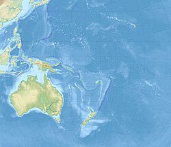
| Epicenter | 15°32′S 171°52′W / 15.53°S 171.87°W[1] |
| Type | Dip-slip (normal and thrust)[2][3] |
| Areas affected | Samoa American Samoa Tonga Cook Islands Fiji French Polynesia New Zealand |
| Max. intensity | MMI VI (Strong)[3] |
| Tsunami | Yes |
| Casualties | at least 189 fatalities[4] hundreds injured[5] |
The 2009 Samoa earthquake and tsunami took place on 29 September 2009 in the southern Pacific Ocean adjacent to the Kermadec-Tonga subduction zone. The submarine earthquake occurred in an extensional environment and had a moment magnitude of 8.1 and a maximum Mercalli intensity of VI (Strong). It was the largest earthquake of 2009. The earthquake initiated with a normal-faulting event with a magnitude of 8.1.[2] Within two minutes of the earthquake rupture, two large magnitude 7.8 earthquakes occurred on the subduction zone interface. The two magnitude 7.8 earthquakes had a combined magnitude equivalent to 8.0.[2] The event can be considered a doublet earthquake.
Normal and thrust faulting triggered a tsunami which caused substantial damage and loss of life in Samoa, American Samoa, and Tonga. The Pacific Tsunami Warning Center recorded a 3-inch (76 mm) rise in sea levels near the epicenter, and New Zealand scientists determined that the waves measured 14 metres (46 ft) at their highest on the Samoan coast.[6] The quake occurred on the outer rise of the Kermadec-Tonga subduction zone. This is part of the Pacific Ring of Fire, where tectonic plates in the Earth's lithosphere meet and earthquakes and volcanic activity are common.
Countries affected by the tsunami, in the areas that were hit are American Samoa, Samoa and Tonga (Niuatoputapu) where more than 189 people were killed, especially children, most of them in Samoa.[7] Large waves with no major damage were reported on the coasts of Fiji, the northern coast of New Zealand[8] and Rarotonga in the Cook Islands. People took precautions in the low-lying atolls of Tokelau and moved to higher ground. Niue was reported as reasonably safe because it is high. There were no reports of high waves from Vanuatu, Kiribati, New Caledonia and the Solomon Islands.[9]
- ^ a b c Cite error: The named reference
ISC-GEMwas invoked but never defined (see the help page). - ^ a b c Thorne Lay; Charles J. Ammon; Hiroo Kanamori; Luis Rivera; Keith D. Koper; Alexander R. Hutko (2010). "The 2009 Samoa–Tonga great earthquake triggered doublet". Nature. 466 (7309): 964–968. Bibcode:2010Natur.466..964L. doi:10.1038/nature09214. PMID 20725038. S2CID 205221482.
- ^ a b Cite error: The named reference
USGSwas invoked but never defined (see the help page). - ^ "tvnz.co.nz-Search continues as death rises". tvnz.co.nz. 2 October 2009. Archived from the original on 6 October 2009. Retrieved 2 October 2009.
- ^ Perry, Michael (29 September 2009). "Samoa tsunami toll may exceed 100, hundreds injured". Reuters. Archived from the original on 3 October 2009. Retrieved 29 September 2009.
- ^ Field, Michael (4 December 2009). "Pacific tsunami four storeys high". stuff.co.nz. Fairfax NZ. Retrieved 5 December 2009.
- ^ "Search for bodies continue, death toll rises in South Pacific | NATIONAL News". Archived from the original on 6 October 2009. Retrieved 2 October 2009.
- ^ "Pacific tsunamis: Countries hit". news.bbc.co.uk. 29 September 2009. Archived from the original on 3 October 2009. Retrieved 30 September 2009.
- ^ "Waves hit Tonga, damage but no casualties". Stuff.co.nz. 30 September 2009. Retrieved 10 September 2011.
© MMXXIII Rich X Search. We shall prevail. All rights reserved. Rich X Search
