Back مسار جوي Arabic Aviatrassa Azerbaijani Corredor aeri Catalan Авианекъ CE Luftstraße German Aerovía Spanish مسیر هوایی Persian Voie aérienne French Aerovía Galician נתיב אווירי HE

In the United States, airways[1] or air routes are defined by the Federal Aviation Administration (FAA) in two ways:
"VOR Federal airways and Low/Medium Frequency (L/MF) (Colored) Federal airways"[2]
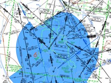
These are designated routes which aeroplanes fly to aid in navigation and help with separation to avoid accidents.[3][4][5][a] Airways are defined with segments within a specific altitude block, corridor width, and between fixed geographic coordinates for satellites navigation system, or between ground-based radio transmitter navigational aids (navaids; such as VORs or NDBs) or the intersection of specific radials of two navaids.
- ^ Wragg, David W. (1973). A Dictionary of Aviation (first ed.). Osprey. p. 31. ISBN 9780850451634.
- ^ "Air Traffic Service Routes - Section 3. Federal Airways". Archived from the original on 2020-10-19.
- ^ Gunston, Bill (2004). The Cambridge Aerospace Dictionary Cambridge. Cambridge University Press. pp. 34. ISBN 978-0521841405.
- ^ FAA regulations 5-3-4. Airways and Route Systems in Section 3. En Route Procedures; archived from www.faa.gov, accessed 25 October 2020
- ^ Airway (definition)- Airway Description www.skybrary.aero, accessed 25 October 2020
Cite error: There are <ref group=lower-alpha> tags or {{efn}} templates on this page, but the references will not show without a {{reflist|group=lower-alpha}} template or {{notelist}} template (see the help page).
© MMXXIII Rich X Search. We shall prevail. All rights reserved. Rich X Search