Back الفالوجة Arabic الفالوجه ARZ الفالوجه Persian אל-פאלוג'ה HE Al-Faluja ID Al-Faludża Polish الفالوجہ Urdu
al-Faluja
الفالوجة al-Faluga | |
|---|---|
 Souk in Faluja, pre 1948 | |
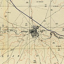
A series of historical maps of the area around Al-Faluja (click the buttons) | |
Location within Mandatory Palestine | |
| Coordinates: 31°37′29″N 34°44′52″E / 31.62472°N 34.74778°E | |
| Palestine grid | 126/114 |
| Geopolitical entity | Mandatory Palestine |
| Subdistrict | Gaza |
| Date of depopulation | Feb-March 1949[3] |
| Area | |
| • Total | 38,038[2] dunams (38.0 km2 or 14.7 sq mi) |
| Population (1945) | |
| • Total | 4,670[1][2] |
| Cause(s) of depopulation | Expulsion by Yishuv forces |
| Current Localities | Kiryat Gat,[4] Shahar,[4] Noga,[4] Nir Chen,[4] Nehora[4] |
al-Faluja (Arabic: الفالوجة) was a Palestinian Arab village in the British Mandate for Palestine, located 30 kilometers northeast of Gaza City. Al-Faluja absorbed settlers from various areas, including Dura.[5]
The village and the neighbouring village of Iraq al-Manshiyya formed part of the Faluja pocket, where 4,000 Egyptian troops, who had entered the area as a result of the 1948 war, were besieged for four months by the newly established Israel Defense Forces.
The 1949 Armistice Agreements allowed for a peaceful transfer of those areas outside Gaza to Israeli control, allowing Egyptian troops to remain in Gaza.[6] Following the agreements, the Arab residents were harassed and abandoned the villages. The Israeli town of Kiryat Gat, as well as the moshav Revaha, border the site of the former town.
- ^ Government of Palestine, Department of Statistics, 1945, p. 31
- ^ a b Government of Palestine, Department of Statistics. Village Statistics, April, 1945. Quoted in Hadawi, 1970, p. 45 Archived 2015-09-24 at the Wayback Machine
- ^ Morris, 2004, p. xix village #319. Also gives cause of depopulation
- ^ a b c d e Khalidi, 1992, p. 97
- ^ Grossman, D. (1986). "Oscillations in the Rural Settlement of Samaria and Judaea in the Ottoman Period". in Shomron studies. Dar, S., Safrai, S., (eds). Tel Aviv: Hakibbutz Hameuchad Publishing House. p. 382
- ^ Nur, Eviatar, ed. (1978), Carta's Atlas of Israel - The First Years 1948-1961, Jerusalem, Israel: Carta
© MMXXIII Rich X Search. We shall prevail. All rights reserved. Rich X Search


