Back الطيرة (حيفا) Arabic الطيره (قضاء حيفا) ARZ א-טירה (חיפה) HE Al-Tira, Haifa ID Al-Tira (Haifa) Italian At-Tira (Hajfa) Polish Al-Tira, Haifa Portuguese الطیرہ، حیفا Urdu Al-Tira, Haifa Uzbek
- See Tira for other sites with similar names.
al-Tira
الطيرة Tirat al-Lawz | |
|---|---|
| Etymology: The Fortress[1] | |
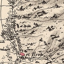
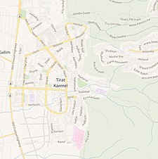
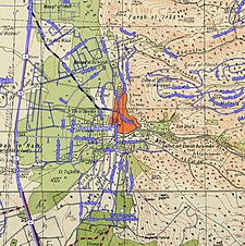
A series of historical maps of the area around Al-Tira, Haifa (click the buttons) | |
Location within Mandatory Palestine | |
| Coordinates: 32°45′43″N 34°58′31″E / 32.76194°N 34.97528°E | |
| Palestine grid | 148/240 |
| Geopolitical entity | Mandatory Palestine |
| Subdistrict | Haifa |
| Date of depopulation | 16 July 1948[3] |
| Area | |
| • Total | 45,262 dunams (45.262 km2 or 17.476 sq mi) |
| Population (1945) | |
| • Total | 5,270[2] |
| Cause(s) of depopulation | Military assault by Yishuv forces |
| Current Localities | HaHotrim,[4][5] Tirat Carmel,[5] Megadim,[5] Kfar Galim,[5] Kfar Tzvi Sitrin[5] |
al-Tira (Arabic: الطيرة, also called Tirat al-Lawz or "Tira of the almonds" to distinguish it from other al-Tiras) was a Palestinian town located 7 kilometres south of Haifa.[6] It was made up of five khirbets, including Khirbat al-Dayr where lie the ruins of St. Brocardus monastery and a cave complex with vaulted tunnels.[7]
The town’s inhabitants fled or were expelled during the war in 1947–1948, and the Israeli town Tirat Carmel was founded on its lands in 1949.[8]
- ^ Palmer, 1881, p. 117
- ^ Department of Statistics, 1945, p. 15
- ^ Morris, 2004, p. xviii, village #173. Also provides cause of depopulation.
- ^ Morris, 2004, p. xx, settlement #8.
- ^ a b c d e Khalidi, 1992, p. 198.
- ^ "Welcome to al-Tira". Palestine Remembered. Retrieved 2007-12-09.
- ^ Rami Nashashibi (1996). "Destroyed Palestinian Villages: al-Tira". Center for Research and Documentation of Palestinian Society. Archived from the original on November 24, 2003. Retrieved 2007-12-09.
- ^ "al-Tira — الطِيرَة". Interactive Encyclopedia of the Palestine Question – palquest. Retrieved 2023-10-30.
© MMXXIII Rich X Search. We shall prevail. All rights reserved. Rich X Search


