Allar
علار | |
|---|---|
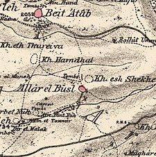
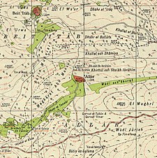
A series of historical maps of the area around Allar, Jerusalem (click the buttons) | |
Location within Mandatory Palestine | |
| Coordinates: 31°43′23″N 35°03′41″E / 31.72306°N 35.06139°E | |
| Palestine grid | 155/125 |
| Geopolitical entity | Mandatory Palestine |
| Subdistrict | Jerusalem |
| Date of depopulation | October 22, 1948[2] |
| Area | |
| • Total | 12,356 dunams (12.356 km2 or 4.771 sq mi) |
| Population (1945) | |
| • Total | 440[1] |
| Cause(s) of depopulation | Military assault by Yishuv forces |
| Current Localities | Mata,[3] Bar Giora[3] |
Allar (Arabic: علار) or 'Allar el-Fawqa ("Upper Allar"), also known as 'Allar el Busl,[4] was a Palestinian Arab village located southwest of the Old City of Jerusalem near Wadi Surar ("Valley of Pebbles"), along Wadi Tannur. The name was shared by the twin village of Allar al-Sifla ("Lower Allar") or Khirbat al-Tannur, with official imperial ledgers often listing them both under the single entry of Allar.[5]
Habitation in the village spanned centuries and is attested in architectural remains and documents from the Crusader, Mamluk, Ottoman and Mandate Palestine periods. Allar was depopulated during the 1948 Arab–Israeli War and the area was incorporated into the State of Israel, with the moshavs of Mata and Bar Giora established on its former lands.
© MMXXIII Rich X Search. We shall prevail. All rights reserved. Rich X Search


