Back Ammagebirg BAR Ammergauské Alpy Czech Ammergauer Alpen German Alpes de Ammergau Spanish Ammergaun Alpit Finnish Alpes d'Ammergau French Alpi dell'Ammergau Italian Elpes Ammergau LLD Ammergauer Alpen Dutch Ammergau-Alpene NB
| Ammergau Alps | |
|---|---|
 | |
| Highest point | |
| Peak | Daniel |
| Elevation | 2,340 m (7,680 ft) |
| Geography | |
| State | Bavarian / Tyrolian border |
| Range coordinates | 47°25′59″N 10°52′48″E / 47.43306°N 10.88000°E |
| Parent range | Northern Limestone Alps |
| Climbing | |
| Normal route | AVE 7a (classification) |


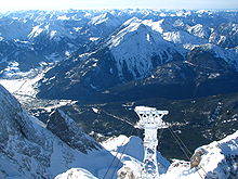
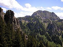
The Ammergau Alps (German: Ammergauer Alpen or Ammergebirge) are a mountain range in the Northern Limestone Alps in the states of Bavaria (Germany) and Tyrol (Austria). They cover an area of about 30 x 30 km and begin at the outer edge of the Alps. The highest summit is the Daniel which has a height of 2,340 metres (7,680 ft).
© MMXXIII Rich X Search. We shall prevail. All rights reserved. Rich X Search