Back Arauca (departement) Afrikaans إدارة أروكا Arabic Arauka (departament) Azerbaijani Araukas departaments BAT-SMG Араука (департамент) Bulgarian Arauca (Kolombia) Breton Departament d'Arauca Catalan Departamento de Arauca CEB Arauca (departement) Czech Departamento de Arauca German
This article has multiple issues. Please help improve it or discuss these issues on the talk page. (Learn how and when to remove these template messages)
|
Department of Arauca
Departamento de Arauca | |
|---|---|
 Sunset over the Arauca River | |
| Motto(s): Vamos Arauca (Spanish: Let's Go Arauca) | |
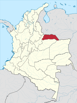
 Arauca shown in red | |
 Topography of the department | |
| Coordinates: 7°05′N 70°45′W / 7.083°N 70.750°W | |
| Country | Colombia |
| Region | Orinoquía Region |
| Established | 4 July 1991 |
| Capital | Arauca |
| Government | |
| • Governor | Ricardo Alvarado Bestene (2016–2019) |
| Area | |
| • Total | 23,818 km2 (9,196 sq mi) |
| • Rank | 18th |
| Population (2018)[1] | |
| • Total | 262,174 |
| • Rank | 27th |
| • Density | 11/km2 (29/sq mi) |
| GDP | |
| • Total | COP 8,548 billion (US$ 2.0 billion) |
| Time zone | UTC-05 |
| ISO 3166 code | CO-ARA |
| Municipalities | 7 |
| HDI (2019) | 0.740[3] high · 20th of 33 |
| Website | www.arauca.gov.co |
Arauca (Spanish pronunciation: [aˈɾawka]) is a department of Eastern Colombia located in the extreme north of the Orinoco Basin of Colombia (the Llanos Orientales), bordering Venezuela. The southern boundary of Arauca is formed by the Casanare and Meta Rivers, separating Arauca from the departments of Casanare and Vichada. To the west, Arauca borders the department of Boyacá. The Caño Limón oil fields located within Arauca account for almost a third of the Colombian oil output. Its capital is the town of Arauca.
- ^ "DANE". Archived from the original on November 13, 2009. Retrieved February 13, 2013.
- ^ "Producto Interno Bruto por departamento", www.dane.gov.co
- ^ "Sub-national HDI - Area Database - Global Data Lab". hdi.globaldatalab.org. Retrieved 2018-09-13.
© MMXXIII Rich X Search. We shall prevail. All rights reserved. Rich X Search

