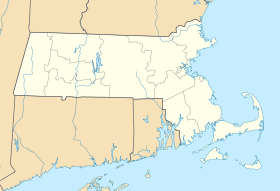
| Ashland State Park | |
|---|---|
 The spillway below the reservoir dam | |
| Location | Ashland, Middlesex, Massachusetts, United States |
| Coordinates | 42°14′30″N 71°27′58″W / 42.24167°N 71.46611°W[1] |
| Area | 470 acres (190 ha)[2] |
| Elevation | 230 ft (70 m)[1] |
| Established | 1947 |
| Governing body | Massachusetts Department of Conservation and Recreation |
| Website | Ashland State Park |
Ashland State Park is a public recreation area surrounding the 157-acre (64 ha) Ashland Reservoir in the town of Ashland, Massachusetts. The state park's 470 acres (190 ha) incorporate the entire shoreline of the reservoir, which is abutted by the Warren Conference Center and Inn[3] of Framingham State University, town-owned land once the site of Camp Winnetaska (a Girl Scouts camp),[4] and residential houses. The park is managed by the Massachusetts Department of Conservation and Recreation.[2]
- ^ a b "Ashland State Park". Geographic Names Information System. United States Geological Survey, United States Department of the Interior.
- ^ a b Cite error: The named reference
dcrwas invoked but never defined (see the help page). - ^ "Warren Conference Center and Inn". Retrieved May 27, 2021.
- ^ Petroni, Susan (March 31, 2015). "Girl Scouts Is Closing Its Only MetroWest Camp". Patch.com. Retrieved May 27, 2021.
© MMXXIII Rich X Search. We shall prevail. All rights reserved. Rich X Search


