Back Azuaga AN زواغة (بطليوس) Arabic ازواجا ARZ آسواقا AZB Azuaga Breton Azuaga Catalan Асуага CE Azuaga (munisipyo) CEB Azuaga Czech Azuaga German
Azuaga | |
|---|---|
| Coordinates: 38°15′32″N 5°40′40″W / 38.25889°N 5.67778°W | |
| Country | |
| Autonomous community | Extremadura |
| Province | Badajoz |
| Comarca | Campiña Sur |
| Judicial district | Llerena |
| Founded | 1st century |
| Government | |
| • Mayor | María Natividad Fuentes del Puerto (2007) (PP) |
| Area | |
| • Total | 497.9 km2 (192.2 sq mi) |
| Elevation | 593 m (1,946 ft) |
| Population (2018)[1] | |
| • Total | 7,891 |
| • Density | 16/km2 (41/sq mi) |
| Demonyms | Azuagueños, Arsenses |
| Time zone | UTC+1 (CET) |
| • Summer (DST) | UTC+2 (CEST) |
| Postal code | 06920 |
| Website | Official website |
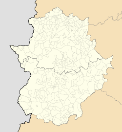
Azuaga (Spanish pronunciation: [aˈθwaɣa]) is a town located in the province of Badajoz in southern Extremadura, bordering the Andalusian provinces of Seville and Córdoba in Spain. Azuga is 140 km from Badajoz, 125 km from Córdoba, and 140 km from Seville, in the foothills of Sierra Morena in the frontier region of Campiña Sur.
With a surface area of 498 km2, Azuaga is the fourth largest municipality by area in the province of Badajoz and includes the village of the Cardenchosa. The inhabitants in 2010 were 8303.
- ^ Municipal Register of Spain 2018. National Statistics Institute.
© MMXXIII Rich X Search. We shall prevail. All rights reserved. Rich X Search

