Bayt Nattif
بيت نتّيف | |
|---|---|
 Bayt Nattif 1948, after occupation | |
| Etymology: The house of Nettif[1] | |
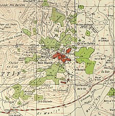
A series of historical maps of the area around Bayt Nattif (click the buttons) | |
Location within Mandatory Palestine | |
| Coordinates: 31°41′32″N 34°59′40″E / 31.69222°N 34.99444°E | |
| Palestine grid | 149/122 |
| Geopolitical entity | Mandatory Palestine |
| Subdistrict | Hebron |
| Date of depopulation | October 21, 1948[2] |
| Population (1945) | |
| • Total | 2,150 |
| Cause(s) of depopulation | Military assault by Yishuv forces |
| Current Localities | Netiv HaLamed-Heh,[3] Aviezer,[3] Neve Michael[3] |
Bayt Nattif or Beit Nattif (Arabic: بيت نتّيف, Hebrew: בית נטיף and בית נתיף alternatively) was a Palestinian Arab village, located some 20 kilometers (straight line distance) southwest of Jerusalem, midway on the ancient Roman road between Beit Guvrin and Jerusalem, and 21 km northwest of Hebron.[4] The village lay nestled on a hilltop, surrounded by olive groves and almonds, with woodlands of oak and carobs overlooking Wadi es-Sunt (the Elah Valley) to its south.[4] It contained several shrines, including a notable one dedicated to al-Shaykh Ibrahim.[4] Roughly a dozen khirbas (deserted, ruined settlements) lay in the vicinity.[4]
During the British Mandate it was part of the Hebron Subdistrict. Bayt Nattif was depopulated during the 1948 Arab–Israeli War on October 21, 1948 under Operation Ha-Har.[4]
© MMXXIII Rich X Search. We shall prevail. All rights reserved. Rich X Search


