Back Beer Tuvia Catalan Oblastní rada Be'er Tovija Czech Beer Tuvia (Regionalverwaltung) German Concejo Regional Beer Tuvia Spanish Be'er Tuvia French מועצה אזורית באר טוביה HE Regionale raad van Beër Tuvia Dutch Be'er Tuvia regionale kommune NN Samorząd Regionu Be’er Towijja Polish Conselho Regional de Be'er Tuvia Portuguese
Be'er Tuvia Regional Council
מועצה אזורית באר טוביה مجلس إقليمي بئر طوفيا | |
|---|---|
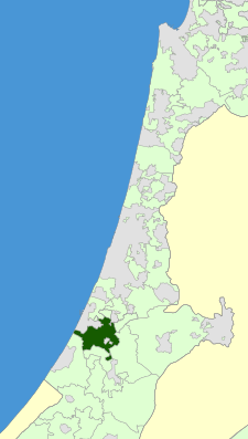
 Council Map. | |
| Country | Israel |
| District | South |
| Founded | 1896 |
| Incorporated | 1950 |
| Government | |
| • Head of Council | Kobi Avivi |
| Area | |
| • Total | 140,000 dunams (140 km2 or 50 sq mi) |
| Population (2009) | |
| • Total | 18,600 |
| Time zone | UTC+2 (IST) |
| • Summer (DST) | UTC+3 (IDT) |
| Website | Official website |
Be'er Tuvia Regional Council (Hebrew: מועצה אזורית באר טוביה, Mo'atza Azorit Be'er Tovia), is a regional council in the Southern District of Israel.
It borders Yoav and Nahal Sorek regional councils in the east; Hof Ashkelon regional council, the Mediterranean Sea, the city of Ashdod and Gan Yavne local council in the west; Gederot, Hevel Yavne regional councils and Gedera, Bnei Aish local councils in the north; Shafir regional council in the south. The town of Kiryat Malakhi is enclaved in the middle.
Be'er Tuvia was incorporated as a regional council in 1950, with a land-area of approximately 140,000 dunams (140 km²). According to the Israel Central Bureau of Statistics, the regional council had a population of 18,600.
© MMXXIII Rich X Search. We shall prevail. All rights reserved. Rich X Search
