Back Bernardston Catalan Бернардстон (Массачусетс) CE Bernardston CEB Bernardston, Massachusetts Welsh Bernardston (Massachusetts) Spanish Bernardston (Massachusetts) Basque برنارداستون، ماساچوست Persian Bernardston Finnish Bernardston French Bernardston, Massachusetts HT
Bernardston, Massachusetts | |
|---|---|
 The former Powers Institute, now the town's Historical Society | |
| Nickname: Falltown | |
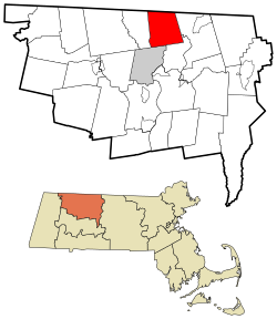
 Location in Franklin County in Massachusetts | |
| Coordinates: 42°40′15″N 72°33′00″W / 42.67083°N 72.55000°W | |
| Country | United States |
| State | Massachusetts |
| County | Franklin |
| Settled | 1738 |
| Incorporated | 1762 |
| Government | |
| • Type | Open town meeting |
| Area | |
| • Total | 23.4 sq mi (60.6 km2) |
| • Land | 23.4 sq mi (60.6 km2) |
| • Water | 0.0 sq mi (0.0 km2) |
| Elevation | 374 ft (114 m) |
| Population (2020) | |
| • Total | 2,102 |
| • Density | 90/sq mi (35/km2) |
| Time zone | UTC−5 (Eastern) |
| • Summer (DST) | UTC−4 (Eastern) |
| ZIP Code | 01337 |
| Area code | 413 |
| FIPS code | 25-05560 |
| GNIS feature ID | 0619378[1] |
| Website | townofbernardston |
Bernardston (/ˈbɜːrnərdstən/) is a town in Franklin County, Massachusetts, United States. The population was 2,102 at the 2020 census.[2] It is part of the Springfield, Massachusetts Metropolitan Statistical Area.
© MMXXIII Rich X Search. We shall prevail. All rights reserved. Rich X Search
