| Betsom's Hill | |
|---|---|
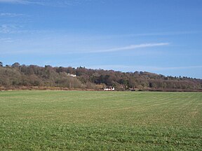
 View of Betsom's Hill from the south-west | |
| Highest point | |
| Elevation | 251 m (823 ft) |
| Listing | County Top |
| Coordinates | 51°17′18″N 0°03′26″E / 51.2882°N 0.057188°E |
| Geography | |
Betsom's Hill in Kent | |
| Location | Westerham, England |
| OS grid | TQ 4355 5633 |
Betsom's Hill is a hill on the North Downs. Situated between Westerham and Tatsfield, at the western edge of the county, it lies close to where the A233 crosses the Downs en route to Biggin Hill. This is the highest part of the North Downs, with Botley Hill the highest point, nearby to the west. The hill lies at the western end of the Kent Downs, an area of outstanding natural beauty.[1][2][3]
- ^ Muir, Jonny (2011). The UK's County Tops: Reaching the top of 91 historic counties. Cicerone. p. 32. ISBN 9781849655538.
- ^ Simon Edwardes (2001). "County Tops". The Mountains of England and Wales. Retrieved 20 April 2014.
- ^ David Bathurst (2 July 2012). Walking the County High Points of England. Summersdale Publishers LTD - ROW. p. 84. ISBN 978-0-85765-755-8.
© MMXXIII Rich X Search. We shall prevail. All rights reserved. Rich X Search

