Bhelupur | |
|---|---|
Suburb | |
 Bhelupur, main road. (West to East view leading to Bhelupur Police Station). Picture taken from Water Works. Road is called "Kamachha Road" | |
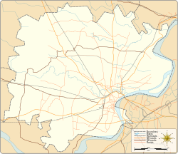
Area location on Varanasi district map | |
| Coordinates: 25°18′14″N 82°59′24″E / 25.303969°N 82.990008°E | |
| Country | |
| State | Uttar Pradesh |
| District | Varanasi |
| Government | |
| • Body | Varanasi Nagar Nigam |
| • MP | Narendra Modi BJP[1](since 2014) |
| • MLA | Jyotsana Srivastava BJP[2] (since 2012) Varanasi Cantonment |
| Elevation | 85 m (279 ft) |
| Languages | |
| • Official | Hindi |
| Time zone | UTC+5:30 (IST) |
| Postal code | 221010 |
| Telephone code | +91-542 |
| Vehicle registration | UP65 XXXX |
| District website | Official website |
Bhelupur (a.k.a. Bhelupura) is a suburban neighbourhood located in south of Varanasi district (Uttar Pradesh). It is situated 2.5 kilometres west of Kedar ghat and to the river Ganges. Benaras Hindu University is situated 4.5 kilometres south of Bhelupur.[3]
Bhelupur is bounded by Rathyatra in North, Lanka in South, Sonarpura in East and Sudamapur Bari Gaibi in the West.[4]
- ^ "Comprehensive Election results". Election Commission of India website. Retrieved 1 February 2015.
- ^ "Varanasi North Result". elections.in. Retrieved 1 February 2015.
- ^ "Coordinates". latlong.net. Archived from the original on 7 August 2017. Retrieved 1 February 2015.
- ^ "Span". Google Maps. Retrieved 1 February 2015.
© MMXXIII Rich X Search. We shall prevail. All rights reserved. Rich X Search

