Back جزر باونتي Arabic Islles Bounty AST Baunti adaları Azerbaijani Баўнці (астравы) Byelorussian Баунти Bulgarian Illes Bounty Catalan Bounty Islands CEB Bounty (souostroví) Czech Bountyinseln German Baŭnti-Insularo Esperanto
Moutere Hauriri (Māori) | |
|---|---|
 Panorama of the entire Bounty Islands archipelago, January 2024 | |
 Map of the Bounty Islands | |
| Geography | |
| Coordinates | 47°45′S 179°03′E / 47.750°S 179.050°E |
| Area | 1[a] km2 (0.39 sq mi) |
| Highest elevation | 73 m (240 ft) |
| Administration | |
| Demographics | |
| Population | 0 |
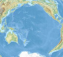
The Bounty Islands (Māori: Moutere Hauriri; "Island of angry wind") are a small group of uninhabited granite islets and numerous rocks, with a combined area of circa 50 ha (120 acres) in the South Pacific Ocean. Territorially part of New Zealand, they lie about 670 km (420 mi) east-south-east of New Zealand's South Island, 530 km (330 mi) south-west of the Chatham Islands, and 215 km (134 mi) north of the Antipodes Islands. The group is a World Heritage Site.[4]
The islands are listed with the New Zealand Outlying Islands. The islands are an immediate part of New Zealand, but not part of any region or district. Rather, they are listed as an Area Outside Territorial Authority, similar to all other outlying islands except for the Solander Islands / Hautere.
- ^ "Bounty Islands". doc.govt.nz. Retrieved 7 February 2024.
- ^ Cite error: The named reference
LINZwas invoked but never defined (see the help page). - ^ "Protected Areas". linz.govt.nz. Retrieved 7 February 2024.
- ^ New Zealand Sub-Antarctic Islands. UNESCO.org (27 June 2013). Retrieved 2 August 2013.
Cite error: There are <ref group=lower-alpha> tags or {{efn}} templates on this page, but the references will not show without a {{reflist|group=lower-alpha}} template or {{notelist}} template (see the help page).
© MMXXIII Rich X Search. We shall prevail. All rights reserved. Rich X Search
