| Bredon Hill | |
|---|---|
 The top of Bredon Hill, with Parsons Folly and the inner rampart of Kemerton Camp | |
| Highest point | |
| Elevation | 299 m (981 ft) |
| Prominence | 257 m (843 ft) |
| Parent peak | The Wrekin |
| Listing | Marilyn |
| Coordinates | 52°03′37″N 2°03′46″W / 52.06016°N 2.06267°W |
| Geography | |
| Location | Worcestershire, England |
| OS grid | SO958402 |
| Topo map | OS Landranger 150 |
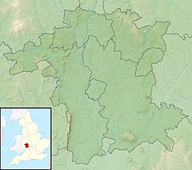
Bredon Hill is a hill in Worcestershire, England, south-west of Evesham in the Vale of Evesham. The summit of the hill is in the parish of Kemerton, and it extends over parts of eight other parishes (listed below). The hill is geologically part of the Cotswolds and lies within the Cotswolds Area of Outstanding Natural Beauty. However, it now stands isolated in the Vale of Evesham due to natural causes.

At the summit, adjacent to Kemerton Camp, is a small stone tower called Parsons Folly which stands at GPS coordinates (52.059963, -2.064606). The tower was built in the mid-18th century for John Parsons, MP (1732–1805), squire of Kemerton Court and intended as a summer house, from which a more extensive view of the surrounding countryside could be seen. The 981-foot (299 m) natural height of the hill contributes to the final height of the tower, whose top now reaches 1,000 feet (305 m). The folly (tower) became a well-known county landmark, and was believed to have inspired the building of Broadway Tower. The current owners, Overbury Estate, lease out the tower as a mobile phone base station, and a number of large aerials have been fitted to its exterior.
© MMXXIII Rich X Search. We shall prevail. All rights reserved. Rich X Search

