Back برلنغتون (آيوا) Arabic بورلينجتون (دى موين) ARZ بورلینقتون، آیووا AZB Burlington (Iowa) BAR Бърлингтън (Айова) Bulgarian Burlington (Iowa) Catalan Берлингтон (Айова) CE Burlington (kapital sa kondado sa Tinipong Bansa, Iowa) CEB Burlington (Iowa) Czech Burlington, Iowa Welsh
Burlington, Iowa
Shoquoquon Flint Hills | |
|---|---|
City | |
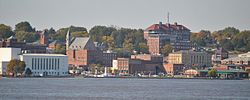
 Downtown Burlington from Mississippi River | |
 Location in the state of Iowa | |
| Coordinates: 40°48′26″N 91°08′12″W / 40.80722°N 91.13667°W | |
| Country | United States |
| State | Iowa |
| County | Des Moines |
| Founded | 1833 |
| Named after | Burlington, Vermont |
| Government | |
| • Type | Mayor–council government |
| Area | |
• Total | 15.17 sq mi (39.29 km2) |
| • Land | 14.41 sq mi (37.32 km2) |
| • Water | 0.76 sq mi (1.98 km2) |
| Elevation | 627 ft (191 m) |
| Population (2020) | |
• Total | 23,982 |
| • Density | 1,664.49/sq mi (642.68/km2) |
| • Demonym | Burlingtonian |
| Time zone | UTC−6 (CST) |
| • Summer (DST) | UTC−5 (CDT) |
| ZIP code | 52601 |
| Area code | 319 |
| FIPS code | 19-09550 |
| GNIS feature ID | 2393469[2] |
| Website | burlingtoniowa.org |
Burlington is a city in, and the county seat of, Des Moines County, Iowa, United States.[3] The population was 23,982 in the 2020 census, a decline from the 26,839 population in 2000.[4] Burlington is the center of a micropolitan area, which includes West Burlington and Middletown, Iowa, and Gulfport, Illinois. Burlington is the home of Snake Alley, the most crooked street in the world.
- ^ "2020 U.S. Gazetteer Files". United States Census Bureau. Retrieved March 16, 2022.
- ^ a b U.S. Geological Survey Geographic Names Information System: Burlington, Iowa
- ^ "Find a County". National Association of Counties. Archived from the original on May 31, 2011. Retrieved June 7, 2011.
- ^ "2020 Census State Redistricting Data". census.gov. United states Census Bureau. Retrieved August 12, 2021.
© MMXXIII Rich X Search. We shall prevail. All rights reserved. Rich X Search