| Casterton Victoria | |||||||||
|---|---|---|---|---|---|---|---|---|---|
 Henty Street (Glenelg Highway), the main street of Casterton. Note the Fleur-de-Lis and the name of the town carved into the hill in the background. | |||||||||
| Coordinates | 37°35′0″S 141°24′0″E / 37.58333°S 141.40000°E | ||||||||
| Population | 1,673 (2021 census) | ||||||||
| Established | 1846 | ||||||||
| Postcode(s) | 3311 | ||||||||
| Elevation | 73 m (240 ft) | ||||||||
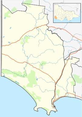
| Location |
| ||||||||
| LGA(s) | Shire of Glenelg | ||||||||
| State electorate(s) | Lowan | ||||||||
| Federal division(s) | Division of Wannon | ||||||||
| |||||||||
Casterton /ˈkɑːstətən, ˈkæs-/[1] is a town in Victoria, Australia, located on the Glenelg Highway, 42 kilometres east of the South Australian border, in the Shire of Glenelg. The Glenelg River passes through the town. Casterton is named after the village of Casterton in south-east Cumbria in England.[2]
- ^ Butler, S., ed. (2009). "Casterton". Macquarie Dictionary (5th ed.). Sydney: Macquarie Dictionary Publishers Pty Ltd. 1952 pages. ISBN 978-18-7642-966-9.
- ^ "Place Details". VICNAMES. State Government of Victoria. Archived from the original on 11 December 2013. Retrieved 7 November 2012.
© MMXXIII Rich X Search. We shall prevail. All rights reserved. Rich X Search

