Back Propinsi Champasak ACE محافظة تشامباساك Arabic Champasak (lalawigan) CEB Чампасак CV Provinz Champasak German Çampasak (wılayet) DIQ Provinco Ĉampasako Esperanto Provincia de Champasak Spanish استان چامپاساک Persian Champasak Finnish
This article is written like a travel guide. (March 2020) |
Champasak province
ແຂວງ ຈຳປາສັກ | |
|---|---|
 | |
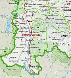
 Map of Champasak province | |
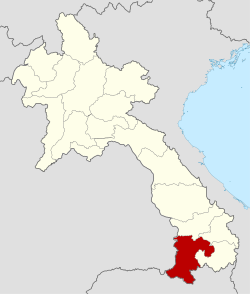
 Location of Champasak province in Laos | |
| Coordinates: 14°52′57″N 105°50′33″E / 14.8825°N 105.8425°E | |
| Country | Laos |
| Capital | Pakse |
| Area | |
| • Total | 15,415 km2 (5,952 sq mi) |
| Population (2020 census) | |
| • Total | 752,688 |
| • Density | 49/km2 (130/sq mi) |
| Time zone | UTC+7 (ICT) |
| ISO 3166 code | LA-CH |
| HDI (2017) | medium · 6th |
Champasak (or Champassak, Champasack – Lao: ຈຳປາສັກ [t͡ɕàm pàː sák]) is a province in southwestern Laos, near the borders with Thailand and Cambodia. It is one of the three principalities that succeeded the Lao kingdom of Lan Xang. As of the 2015 census, it had a population of 694,023. The capital is Pakse, but the province takes its name from Champasak, the former capital of the Kingdom of Champasak.
Champasak is bordered by Salavan province to the north, Sekong province to the northeast, Attapeu province to the east, Cambodia to the south, and Thailand to the west. The Mekong River forms part of the border with neighboring Thailand and contains Si Phan Don ('Four Thousand Islands') in the south of the province, on the border with Cambodia.
Champasak has played a central role in the history of Siam and Laos, with frequent battles taking place in and around Champasak.[2] Its cultural heritage includes ancient temple ruins and French colonial architecture. Champasak has some 20 wats (temples), such as Wat Phou, Wat Luang, and Wat Tham Fai. Freshwater dolphins and the province's many waterfalls are tourist attractions.[2]
- ^ "Sub-national HDI - Area Database - Global Data Lab". hdi.globaldatalab.org. Retrieved 2018-09-13.[not specific enough to verify]
- ^ a b "Destination: Champasack Province Destination". Laos Tourism Organization. Archived from the original on 14 October 2012. Retrieved 1 November 2012.
© MMXXIII Rich X Search. We shall prevail. All rights reserved. Rich X Search