Back نهر تشيرى كريك ARZ Cherry Creek (suba sa Tinipong Bansa, Colorado, Denver County) CEB Cherry Creek (Colorado) French
This article needs additional citations for verification. (January 2011) |
| Cherry Creek[1] | |
|---|---|
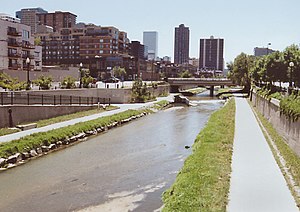
 Cherry Creek in Denver | |
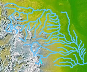
 Cherry Creek's location in the western part of the Missouri River watershed, highlighted in light blue | |
| Physical characteristics | |
| Source | |
| • location | Confluence of West Cherry Creek and East Cherry Creek |
| • coordinates | 39°17′08.7″N 104°42′59.0″W / 39.285750°N 104.716389°W |
| Mouth | |
• location | Confluence with South Platte |
• coordinates | 39°45′16.4″N 105°00′29.6″W / 39.754556°N 105.008222°W |
• elevation | 5,167 ft (1,575 m) |
| Basin features | |
| Progression | South Platte—Platte— Missouri—Mississippi |


Cherry Creek is a tributary of the South Platte River, 48.0 miles (77.2 km) long,[2] in Colorado in the United States.[3]
- ^ "Cherry Creek". Geographic Names Information System. United States Geological Survey, United States Department of the Interior. Retrieved 2011-01-26.
- ^ "USGS TNM 2.0 Viewer". Viewer.nationalmap.gov. Archived from the original on 2012-03-29. Retrieved 2012-10-13.
- ^ "Cherry Creek - Denver Colorado". Denvermall.net. Archived from the original on 2012-03-17. Retrieved 2012-10-13.
© MMXXIII Rich X Search. We shall prevail. All rights reserved. Rich X Search