Back مقاطعة تشوكتاو (ميسيسيبي) Arabic Choctaw County, Mississippi BAR Чокто (окръг, Мисисипи) Bulgarian চকটৌ কাউন্টি, মিসিসিপি BPY Choctaw Gông (Mississippi) CDO Чокто (гуо, Миссисипи) CE Choctaw County (kondado sa Tinipong Bansa, Mississippi) CEB Choctaw County (Mississippi) Czech Choctaw County, Mississippi Welsh Choctaw County (Mississippi) Danish
Choctaw County | |
|---|---|
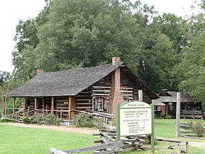
 French Camp. Historic Mississippi cabin. | |
 Location within the U.S. state of Mississippi | |
 Mississippi's location within the U.S. | |
| Coordinates: 33°21′N 89°15′W / 33.35°N 89.25°W | |
| Country | |
| State | |
| Founded | 1833 |
| Named for | Choctaw people |
| Seat | Ackerman |
| Largest town | Ackerman |
| Area | |
| • Total | 420 sq mi (1,100 km2) |
| • Land | 418 sq mi (1,080 km2) |
| • Water | 1.7 sq mi (4 km2) 0.4% |
| Population (2020) | |
| • Total | 8,246 |
| • Density | 20/sq mi (7.6/km2) |
| Time zone | UTC−6 (Central) |
| • Summer (DST) | UTC−5 (CDT) |
| Congressional district | 1st |
| Website | choctawcountyms |
Choctaw County is a county located in the central part of the U.S. state of Mississippi. As of the 2020 census, the population was 8,246.[1] Its northern border is the Big Black River, which flows southwest into the Mississippi River south of Vicksburg. The county seat is Ackerman.[2]
The county is named after the Choctaw tribe of Native Americans. They had long occupied this territory as their homeland before European exploration. Under the Indian Removal Act of 1830, they were forced by the United States to cede their lands and to move west of the Mississippi River to what became Indian Territory (today's state of Oklahoma).
- ^ "Census - Geography Profile: Choctaw County, Mississippi". United States Census Bureau. Retrieved January 8, 2023.
- ^ "Find a County". National Association of Counties. Archived from the original on May 9, 2015. Retrieved June 7, 2011.
© MMXXIII Rich X Search. We shall prevail. All rights reserved. Rich X Search