Back Санто-Доминго колониаль ҡалаһы Bashkir Ciudad Colonial Spanish سیداد کولونیال Persian Ville coloniale de Saint-Domingue French Cidade Colonial de Santo Domingo Galician העיר הקולוניאלית של סנטו דומינגו HE Città coloniale Italian サントドミンゴの植民都市 Japanese სიუდად-კოლონიალი (სანტო-დომინგო) Georgian Cidade Colonial de São Domingos Portuguese
Ciudad Colonial | |
|---|---|
Historic district | |
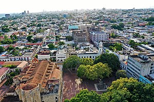
 Aerial view of Columbus Park in colonial district of Santo Domingo | |
 Map of Santo Domingo, 1873 | |
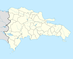
| Coordinates: 18°29′N 69°55′W / 18.483°N 69.917°W | |
| Country | Dominican Republic |
| Province | Distrito Nacional |
| City | Santo Domingo |
| Time zone | UTC-4 |
| Official name | Colonial City of Santo Domingo |
| Location | Santo Domingo, Dominican Republic |
| Includes | |
| Criteria | Cultural: (ii), (iv), (vi) |
| Reference | 526 |
| Inscription | 1990 (14th Session) |
| Area | 106 ha (0.41 sq mi) |
Ciudad Colonial (Spanish for "Colonial City") is the historic central neighborhood of the Dominican Republic's capital Santo Domingo. It is the oldest continuously inhabited European-established settlement in the Americas. The area has been declared a World Heritage Site by UNESCO.[1] It is also known as Zona Colonial (Colonial Zone) or more colloquially as "La Zona" (The Zone).
The Ciudad Colonial is located on the west bank of the Ozama River, which bisects the city. It covers 1.06 km2 (0.41 sq mi) bounded by a walled perimeter. It is an important section of the city due to the high number of landmarks, including Alcázar de Colón, Fortaleza Ozama, Catedral de Santa María la Menor, and others. The area is the main tourist attraction of Santo Domingo, even though the main sites of governmental and commercial activity are now in the more modern parts of the city.
- ^ "Colonial City of Santo Domingo - UNESCO World Heritage Centre". Archived from the original on 2008-05-17. Retrieved 2007-05-07.
© MMXXIII Rich X Search. We shall prevail. All rights reserved. Rich X Search
