Back Clark Township (Brown County, Ohio) German Municipio de Clark (condado de Brown) Spanish Clark udalerria, Brown konderria (Ohio) Basque بخش کلارک، شهرستان براون، اوهایو Persian Município de Clark (condado de Brown, Ohio) Portuguese کلارک ٹاؤن شپ، براؤن کاؤنٹی، اوہائیو Urdu Xã Clark, Quận Brown, Ohio Vietnamese
Clark Township, Brown County, Ohio | |
|---|---|
 Mount Nebo United Methodist Church, State Route 774 | |
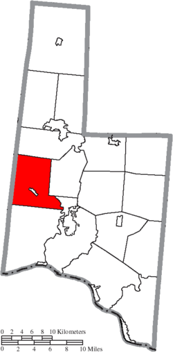
 Location of Clark Township in Brown County | |
| Coordinates: 38°55′27″N 83°59′26″W / 38.92417°N 83.99056°W | |
| Country | United States |
| State | Ohio |
| County | Brown |
| Area | |
| • Total | 29.64 sq mi (76.77 km2) |
| • Land | 29.63 sq mi (76.75 km2) |
| • Water | 0.008 sq mi (0.02 km2) |
| Elevation | 968 ft (295 m) |
| Population (2020) | |
| • Total | 2,952 |
| • Density | 100/sq mi (38/km2) |
| Time zone | UTC-5 (Eastern (EST)) |
| • Summer (DST) | UTC-4 (EDT) |
| FIPS code | 39-15224[2] |
| GNIS feature ID | 1085793[1] |
Clark Township is one of the sixteen townships of Brown County, Ohio, United States. The 2020 census found 2,952 people in the township.[3]
- ^ a b "US Board on Geographic Names". United States Geological Survey. October 25, 2007. Retrieved January 31, 2008.
- ^ "U.S. Census website". United States Census Bureau. Retrieved January 31, 2008.
- ^ "Clark township, Brown County, Ohio - Census Bureau Profile". United States Census Bureau. Retrieved May 26, 2023.
© MMXXIII Rich X Search. We shall prevail. All rights reserved. Rich X Search