Back Camp de gel Columbia Catalan Columbia Icefield (kalo nga yelo) CEB Columbia Icefield Danish Columbia-Eisfeld German Campo de hielo Columbia Spanish Columbia jääväli Estonian Columbiako izotz eremua Basque Champ de glace Columbia French שדה הקרח קולומביה HE Կոլումբիական սառցադաշտ Armenian
| Columbia Icefield | |
|---|---|
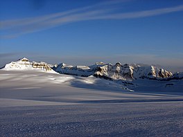
 Columbia Icefield with Mt. Castleguard at the left. | |
| Type | Icefield |
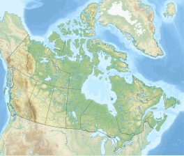
| Coordinates | 52°09′26″N 117°18′50″W / 52.15722°N 117.31389°W |
| Terminus | outflow glaciers |
 | |
The Columbia Icefield is the largest ice field in North America's Rocky Mountains.[1] Located within the Canadian Rocky Mountains astride the Continental Divide along the border of British Columbia and Alberta, Canada, the ice field lies partly in the northwestern tip of Banff National Park and partly in the southern end of Jasper National Park.[1][2] It is about 325 square kilometres (125 sq mi) in area, 100 to 365 metres (328 to 1,198 ft) in depth and receives up to 7 metres (280 in) of snowfall per year.[2]
© MMXXIII Rich X Search. We shall prevail. All rights reserved. Rich X Search


