Back مقاطعة كونفيرس (وايومنغ) Arabic Konvers (Vayominq) Azerbaijani Converse County, Wyoming BAR Кънвърс (окръг) Bulgarian কনভার্স কাউন্টি, ৱাইওমিং BPY Converse Gông (Wyoming) CDO Конверс (гуо, Вайоминг) CE Converse County CEB Converse County, Wyoming Welsh Converse County German
Converse County | |
|---|---|
 | |
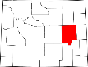
 Location within the U.S. state of Wyoming | |
 Wyoming's location within the U.S. | |
| Coordinates: 42°58′N 105°30′W / 42.97°N 105.5°W | |
| Country | |
| State | |
| Founded | March 9, 1888 |
| Named for | A.R. Converse |
| Seat | Douglas |
| Largest city | Douglas |
| Area | |
| • Total | 4,265 sq mi (11,050 km2) |
| • Land | 4,255 sq mi (11,020 km2) |
| • Water | 10 sq mi (30 km2) 0.2% |
| Population (2020) | |
| • Total | 13,751 |
| • Density | 3.2/sq mi (1.2/km2) |
| Time zone | UTC−7 (Mountain) |
| • Summer (DST) | UTC−6 (MDT) |
| Congressional district | At-large |
| Website | conversecounty |

Converse County is a county located in the U.S. state of Wyoming. As of the 2020 United States Census, the population was 13,751.[1] Its county seat is Douglas.[2]
- ^ "State & County QuickFacts". US Census Bureau. Archived from the original on January 30, 2016. Retrieved January 25, 2014.
- ^ "Find a County". National Association of Counties. Archived from the original on May 31, 2011. Retrieved June 7, 2011.
© MMXXIII Rich X Search. We shall prevail. All rights reserved. Rich X Search