| Cooks River | |
|---|---|
 Cooks River near Sydney Airport | |
| Native name | Goolay'yari (Dharuk) (Cadigal) |
| Location | |
| Country | Australia |
| State | New South Wales |
| Region | Sydney basin (IBRA), Inner West |
| City | Sydney |
| Physical characteristics | |
| Source | Graf Park |
| • location | Yagoona |
| Mouth | Botany Bay |
• location | Kyeemagh |
• coordinates | 33°56′57″S 151°10′06″E / 33.94917°S 151.16833°E |
| Length | 23 km (14 mi) |
| Basin size | 100 km2 (39 sq mi) |
| Basin features | |
| River system | Botany Bay |
| Tributaries | |
| • left | Cup and Saucer Creek, Alexandra Canal |
| • right | Coxs Creek, Wolli Creek |
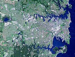
The Cooks River, a semi-mature tide-dominated drowned valley estuary,[1] is a tributary of Botany Bay, located in south-western Sydney, New South Wales, Australia.
The course of the 23-kilometre-long (14 mi) urban waterway has been altered to accommodate various developments along its shore. It serves as part of a stormwater system for the 100 square kilometres (39 sq mi) of its watershed, and many of the original streams running into it have been turned into concrete lined channels. The tidal sections support significant areas of mangroves, bird, and fish life, and are used for recreational activities.
- ^ "Cooks River: Physical characteristics". Office of Environment & Heritage. 26 April 2012. Retrieved 7 September 2012.
© MMXXIII Rich X Search. We shall prevail. All rights reserved. Rich X Search

