Back مقاطعة كوبر (ميزوري) Arabic کوپر بؤلگهسی، میزوری AZB Cooper County, Missouri BAR Купър (окръг, Мисури) Bulgarian কোপার কাউন্টি, মিসৌরি BPY Cooper Gông (Missouri) CDO Купер (гуо, Миссури) CE Cooper County CEB Cooper County, Missouri Welsh Cooper County German
Cooper County | |
|---|---|
 Cooper County Courthouse in Boonville | |
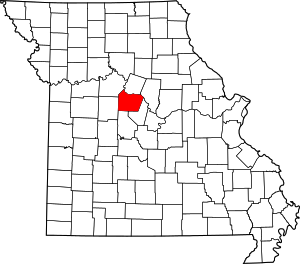
 Location within the U.S. state of Missouri | |
 Missouri's location within the U.S. | |
| Coordinates: 38°51′N 92°49′W / 38.85°N 92.81°W | |
| Country | |
| State | |
| Founded | December 17, 1818 |
| Named for | Sarshell Cooper |
| Seat | Boonville |
| Largest city | Boonville |
| Area | |
| • Total | 569 sq mi (1,470 km2) |
| • Land | 565 sq mi (1,460 km2) |
| • Water | 4.4 sq mi (11 km2) 0.8% |
| Population (2020) | |
| • Total | 17,103 |
| • Density | 30/sq mi (12/km2) |
| Time zone | UTC−6 (Central) |
| • Summer (DST) | UTC−5 (CDT) |
| Congressional district | 4th |
| Website | www |
Cooper County is located in the central portion of the U.S. state of Missouri. As of the 2020 United States census, the population was 17,103.[1] Its county seat is Boonville.[2] The county was organized December 17, 1818, and named for Sarshell Cooper, a frontier settler who was killed by Native Americans near Arrow Rock in 1814.[3][4] It is a part of the Columbia, Missouri metropolitan area.
- ^ "Explore Census Data".
- ^ "Find a County". National Association of Counties. Archived from the original on May 31, 2011. Retrieved June 7, 2011.
- ^ Gannett, Henry (1905). The Origin of Certain Place Names in the United States. Govt. Print. Off. pp. 90.
- ^ Eaton, David Wolfe (1916). How Missouri Counties, Towns and Streams Were Named. The State Historical Society of Missouri. pp. 280.
© MMXXIII Rich X Search. We shall prevail. All rights reserved. Rich X Search