Back Crawley (bahin nga lungsod) CEB Crawley (Australie-Occidentale) French Crawley (Nyugat-Ausztrália) Hungarian Crawley, Australien Swedish
| Crawley Perth, Western Australia | |||||||||||||||
|---|---|---|---|---|---|---|---|---|---|---|---|---|---|---|---|
 | |||||||||||||||
 | |||||||||||||||
| Coordinates | 31°59′10″S 115°49′19″E / 31.986°S 115.822°E | ||||||||||||||
| Population | 3,975 (SAL 2021)[1] | ||||||||||||||
| Postcode(s) | 6009 | ||||||||||||||
| Area | 1.4 km2 (0.5 sq mi)[2] | ||||||||||||||
| Location | 5.8 km (4 mi) SW of the Perth CBD | ||||||||||||||
| LGA(s) | City of Perth | ||||||||||||||
| State electorate(s) | Nedlands | ||||||||||||||
| Federal division(s) | Curtin | ||||||||||||||
| |||||||||||||||
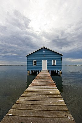
Crawley is a western suburb of Perth, the capital city of Western Australia. The area is part of the local government area of the City of Perth and was previously shared between the City of Subiaco and City of Perth.[3][4] It is about 5.8 kilometres (4 mi) from the Perth CBD via Mounts Bay Road.
The earlier name of the locality was Crawley Park.[5] It was named by an early landowner, Henry Charles Sutherland, whose mother's maiden name was Crawley.[6]
It is home to the University of Western Australia, the state's oldest university.
- ^ Australian Bureau of Statistics (28 June 2022). "Crawley (suburb and locality)". Australian Census 2021 QuickStats. Retrieved 28 June 2022.
- ^ Australian Bureau of Statistics (28 June 2022). "2021 Community Profiles: Crawley (Suburbs and Localities)". 2021 Census of Population and Housing. Retrieved 17 July 2022.
- ^ "Submission to the Local Government Advisory Board" (PDF). City of Nedlands. June 2014. Retrieved 13 April 2022.[permanent dead link]
- ^ Parker, Gareth (23 October 2014). "Mergers leave 3000 without a council". The West Australian. Perth. Retrieved 13 April 2022.
- ^ Brain, Alison V.(2001) Crawley Park and its occupants, 1829-1910. Early days, Vol.12, pt.1 (2001), p.39-46
- ^ "Crawley History Perth Real Estate". 28 June 2016.
© MMXXIII Rich X Search. We shall prevail. All rights reserved. Rich X Search