Back دهب Arabic دهب (مدينه) ARZ Dəhəb Azerbaijani Дахаб Bulgarian Dhahab CEB Dahab Czech Dahab German Dahab Esperanto Dahab Spanish Dahab Estonian
Dahab | |
|---|---|
coastal town | |
Overview of Dahab, its beaches and coral reef | |
| Coordinates: 28°29′35″N 34°30′17″E / 28.49306°N 34.50472°E | |
| Country | |
| Governorate | South Sinai |
| Area | |
| • Total | 418 sq mi (1,083 km2) |
| Elevation | 69 ft (21 m) |
| Population (2021)[1] | |
| • Total | 3,106 |
| • Density | 7.4/sq mi (2.9/km2) |
| Time zone | UTC+2 (EST) |
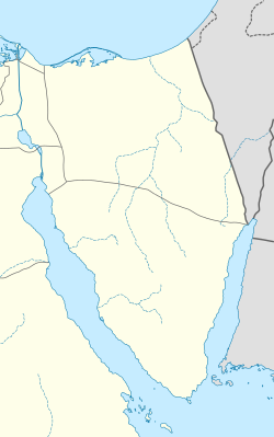
Dahab (Egyptian Arabic: دهب, IPA: [ˈdæhæb], "gold") is a small Egyptian town on the southeast coast of the Sinai Peninsula in Egypt, approximately 80 km (50 mi) northeast of Sharm el-Sheikh.
Dahab can be divided into three major parts. Masbat, which includes the Bedouin village of Asalah, is in the north. South of Masbat is Mashraba, which is more touristic and has considerably more hotels. In the southwest is Medina which includes the Laguna area, famous for its excellent shallow-water kite- and windsurfing.[2]
The region of Asalah is quite developed and has many campsites and hostels. Most people who have visited Dahab in the past are backpackers interested in diving and snorkeling in the Red Sea. The town of Dahab counts around 15,000 inhabitants.[2]
- ^ a b c "Dahab (Kism (urban and rural parts), Egypt) - Population Statistics, Charts, Map and Location". citypopulation.de. Retrieved 17 March 2023.
- ^ a b "Dahab - Red Sea", TripAdvisor.com, retrieved 25 August 2023
© MMXXIII Rich X Search. We shall prevail. All rights reserved. Rich X Search


