Back مقاطعة داوسون (جورجيا) Arabic داوسون بؤلگهسی، جورجیا AZB Dawson County, Georgia BAR Досън (окръг, Джорджия) Bulgarian ডাৱসন কাউন্টি, জর্জিয়া BPY Dawson Gông (Georgia) CDO Досон (гуо, Джорджи) CE Dawson County (kondado sa Tinipong Bansa, Georgia) CEB Dawson County (Georgie) Czech Dawson County, Georgia Welsh
Dawson County | |
|---|---|
 Dawson County Courthouse in Dawsonville | |
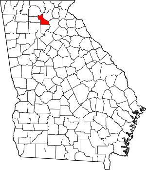
 Location within the U.S. state of Georgia | |
 Georgia's location within the U.S. | |
| Coordinates: 34°26′N 84°10′W / 34.44°N 84.17°W | |
| Country | |
| State | |
| Founded | 1857 |
| Named for | William Crosby Dawson |
| Seat | Dawsonville |
| Largest city | Dawsonville |
| Area | |
| • Total | 214 sq mi (550 km2) |
| • Land | 211 sq mi (550 km2) |
| • Water | 3.6 sq mi (9 km2) 1.7% |
| Population (2020) | |
| • Total | 26,798 [1] |
| Time zone | UTC−5 (Eastern) |
| • Summer (DST) | UTC−4 (EDT) |
| Congressional district | 6th |
| Website | www |
Dawson County is a county located in the Northeast portion of the U.S. state of Georgia. As of the 2020 census, the population was 26,798 up from 22,330 in 2010.[2][1] The county seat is Dawsonville.[3]
Dawson County is included in the Atlanta-Sandy Springs-Roswell, Georgia Metropolitan Statistical Area. Its natural resources include Amicalola Falls, the highest falls in Georgia and one of the Seven Natural Wonders of the state.
- ^ a b US 2020 Census Bureau report, Dawson County, Georgia
- ^ "State & County QuickFacts". United States Census Bureau. Archived from the original on June 7, 2011. Retrieved February 15, 2014.
- ^ "Find a County". National Association of Counties. Archived from the original on May 31, 2011. Retrieved June 7, 2011.
© MMXXIII Rich X Search. We shall prevail. All rights reserved. Rich X Search

