Back Dutch Harbor (lungsod) CEB Dutch Harbor ID Dutch Harbor Italian ダッチハーバー Japanese Dutch Harbor Dutch 荷蘭港 Chinese Dutch Harbor (Alaska) ZH-MIN-NAN
Dutch Harbor | |
|---|---|
Harbor | |
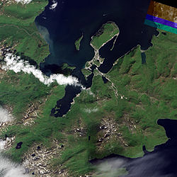
 Natural-color image of Dutch Harbor | |
| Coordinates: 53°54′10.5″N 166°31′06.2″W / 53.902917°N 166.518389°W | |
| Country | United States |
| City | Unalaska, Alaska |
| Time zone | UTC-9 (Alaska (AKST)) |
| • Summer (DST) | UTC-8 (AKDT) |
| ZIP code | 99692[1] |
| Area code | 907 |
Dutch Harbor is a harbor on Amaknak Island in Unalaska, Alaska. It was the location of the Battle of Dutch Harbor in June 1942 and was one of the few sites in the United States to be subjected to aerial bombardment by a foreign power during World War II. It was also one of the few sites, besides the attack on Pearl Harbor in Hawaii, in incorporated U.S. territory to be bombed by the Japanese in the war.[2]
Dutch Harbor is now the home of an important fishing industry.[3]
- ^ "Dutch Harbor ZIP Code". zipdatamaps.com. 2022. Retrieved November 11, 2022.
- ^ "Unalaska – History of Unalaska". Archived from the original on 2010-08-01. Retrieved 2012-10-14.
- ^ "Unalaska - About Unalaska". Archived from the original on 2012-10-02. Retrieved 2012-10-14.
© MMXXIII Rich X Search. We shall prevail. All rights reserved. Rich X Search


