Back عين حوض Arabic عين حوض (تجمع سكان فى مجلس اقليمى شاطئ الكرمل) ARZ ‘En Hod CEB Ejn Hod Czech En Hod German Ein Hod Spanish Ein Hod Finnish Ein Hod French עין הוד HE Ein Hod ID
Ein Hod
עֵין הוֹד | |
|---|---|
 | |
| Coordinates: 32°42′05″N 34°58′48″E / 32.70139°N 34.98000°E | |
| Country | |
| District | Haifa |
| Council | Hof HaCarmel |
| Population (2022)[1] | 664 |
| Website | ein-hod.org |
Ayn Hawd
عين حوض | |
|---|---|
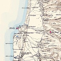
 Map of Ayn Hawd and surrounding area, 1870s. The Survey of Western Palestine. London:Committee of the Palestine Exploration Fund | |
| Etymology: Spring of the cistern[2] | |
| Coordinates: 32°42′05″N 34°58′48″E / 32.70139°N 34.98000°E | |
| Palestine grid | 148/234 |
| Geopolitical entity | Mandatory Palestine |
| Subdistrict | Haifa |
| Date of depopulation | 15 July 1948[5] |
| Area | |
| • Total | 12,605 dunams (12.605 km2 or 4.867 sq mi) |
| Population (1945) | |
| • Total | 650[3][4] |
| Cause(s) of depopulation | Military assault by Yishuv forces |
| Current localities | Ein Hod[6][7] Nir Etzion[7] |
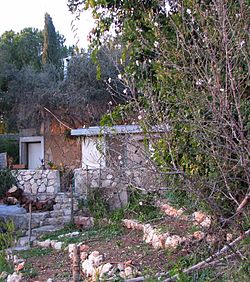
Ein Hod (Hebrew: עֵין הוֹד) is a village in Haifa District in northern Israel. Located at the foot of Mount Carmel and southeast of Haifa, it falls under the jurisdiction of Hof HaCarmel Regional Council and has the status of community settlement. In 2022 it had a population of 664.[1]
The village is situated on a hillside amidst olive groves, with a view of the Mediterranean Sea. Prior to the 1948 Arab–Israeli War Ein Hod was the site of the Arabic village of Ein Hawd. Most of the Arab inhabitants were expelled during the war, however some remained in the area and settled nearby, forming a new village, also by the name of Ein Hawd.
After a failed attempt to create a moshav on the site, Ein Hod became an artists' colony in 1953.
- ^ a b "Regional Statistics". Israel Central Bureau of Statistics. Retrieved 21 March 2024.
- ^ Palmer, 1881, p. 105
- ^ Government of Palestine, Department of Statistics, 1945, p. 13
- ^ a b Government of Palestine, Department of Statistics. Village Statistics, April, 1945. Quoted in Hadawi, 1970, p. 47
- ^ Morris, 2004, p. XVIII, village #170. Also gives causes of depopulation.
- ^ Morris, 2004, p. XXII, Settlement #123, established 1949.
- ^ a b Khalidi, 1992, p. 151
© MMXXIII Rich X Search. We shall prevail. All rights reserved. Rich X Search


