| Hervey Bay Queensland—Legislative Assembly | |||||||||||||||
|---|---|---|---|---|---|---|---|---|---|---|---|---|---|---|---|
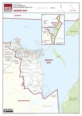 Map of the electoral district of Hervey Bay, 2017 | |||||||||||||||
| State | Queensland | ||||||||||||||
| Dates current | 1992–present | ||||||||||||||
| MP | Adrian Tantari | ||||||||||||||
| Party | Labor | ||||||||||||||
| Namesake | Hervey Bay | ||||||||||||||
| Electors | 39,626 (2020) | ||||||||||||||
| Area | 1,809 km2 (698.5 sq mi) | ||||||||||||||
| Demographic | Provincial (mainland) and remote (Fraser Island) | ||||||||||||||
| Coordinates | 25°15′S 153°3′E / 25.250°S 153.050°E | ||||||||||||||
| |||||||||||||||

Hervey Bay is an electoral district of the Legislative Assembly in the Australian state of Queensland. The electorate is centred on the city of Hervey Bay and also includes Fraser Island (K'gari, Gari).[1]
- ^ "Representatives of Queensland State Electorates 1860-2017" (PDF). Queensland Parliamentary Record 2012-2017: The 55th Parliament. Queensland Parliament. Archived from the original (PDF) on 27 April 2020.
© MMXXIII Rich X Search. We shall prevail. All rights reserved. Rich X Search