| Powerline Road | ||||
SR 845 highlighted in red | ||||
| Route information | ||||
| Maintained by FDOT | ||||
| Length | 16.314 mi[1] (26.255 km) | |||
| Major junctions | ||||
| South end | ||||
| North end | ||||
| Location | ||||
| Country | United States | |||
| State | Florida | |||
| Counties | Broward, Palm Beach | |||
| Highway system | ||||
| ||||

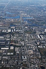
State Road 845 (SR 845), locally known as Powerline Road, is a 16.314-mile-long (26.255 km) north–south divided highway serving northern Broward County and southern Palm Beach County, Florida, United States. The route extends from an intersection with Sunrise Boulevard (SR 838) near downtown Ft. Lauderdale, north to an intersection with Glades Road (SR 808) near Boca Raton.
Like Military Trail (SR 809) to the east, SR 845 is a major commuter highway paralleling Florida's Turnpike (SR 91) and Interstate 95 (I-95) and often used as an alternative for the often-congested expressways. The road received its name from the parallel high tension power lines for almost its entire length.
© MMXXIII Rich X Search. We shall prevail. All rights reserved. Rich X Search


