Back جغرافيا أيسلندا Arabic Xeografía d'Islandia AST География на Исландия Bulgarian আইসল্যান্ডের ভূগোল Bengali/Bangla Geografie Islandu Czech Islands geografi Danish Geographie Islands German Geografía de Islandia Spanish جغرافیای ایسلند Persian Islannin maantiede Finnish
 | |
| Continent | Europe |
|---|---|
| Region | Northern Europe |
| Coordinates | 65°00′N 18°00′W / 65.000°N 18.000°W |
| Area | Ranked 106 |
| • Total | 103,001 km2 (39,769 sq mi) |
| • Land | 97.33% |
| • Water | 2.67% |
| Coastline | 4,970 km (3,090 mi) |
| Borders | None |
| Highest point |
|
| Lowest point |
|
| Longest river |
|
| Largest lake |
|
| Climate | Subpolar oceanic climate, Tundra |
| Terrain | Plateau interspersed with mountain peaks, volcanic peaks, icefields and a coast deeply indented by bays and fjords |
| Natural resources | Marine life, diatomite, hydrothermal power |
| Natural hazards | Volcanism, earthquakes, avalanches, and glacial lake outburst flooding |
| Environmental issues | Air pollution, climate change, desertification, hazardous wastes, marine dumping |
| Exclusive economic zone | 751,345 km2 (290,096 sq mi) |
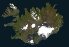
Iceland is an island country at the confluence of the North Atlantic and Arctic oceans, east of Greenland and immediately south of the Arctic Circle, atop the constructive boundary of the northern Mid-Atlantic Ridge. The island country is the world's 18th largest in area and one of the most sparsely populated. It is the westernmost European country when not including Greenland and has more land covered by glaciers than continental Europe. Its total size is 103,125 km2 (39,817 sq mi) and possesses an exclusive economic zone of 751,345 km2 (290,096 sq mi).
© MMXXIII Rich X Search. We shall prevail. All rights reserved. Rich X Search