Back Gepps Cross CEB گپس کراس، استرالیای جنوبی Persian Gepps Cross Swedish Gepps Cross, Nam Úc Vietnamese
| Gepps Cross Adelaide, South Australia | |||||||||||||||
|---|---|---|---|---|---|---|---|---|---|---|---|---|---|---|---|
 Gepps Cross Intersection with the historic Gepp's Cross Inn (currently Coopers Alehouse). | |||||||||||||||
| Coordinates | 34°50′28″S 138°36′14″E / 34.841°S 138.604°E | ||||||||||||||
| Population | 648 (SAL 2021)[1] | ||||||||||||||
| Postcode(s) | 5094 | ||||||||||||||
| LGA(s) | City of Port Adelaide Enfield | ||||||||||||||
| State electorate(s) | Port Adelaide | ||||||||||||||
| Federal division(s) | Makin | ||||||||||||||
| |||||||||||||||
| Footnotes | [2] | ||||||||||||||
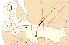
Gepps Cross (/dʒɛps/ JEPS) is a suburb and major road intersection in the north of Adelaide, South Australia. Gepps Cross is traditionally seen as the end of the inner suburbs and the start of the outer northern suburbs, as it was home to a major abattoir (now closed and demolished) with holding yards and other open space. It is the first significant open space encountered after the North Parklands. It retains the open nature, even with warehouses, a velodrome, hockey stadium, Adelaide Raiders – a Croatian soccer club, and karate training facilities.
Gepps Cross is best known for the five-way intersection with Grand Junction Road going east and west, Main North Road south and north-east, and Port Wakefield Road going north. The intersection is not grade-separated. It is controlled by traffic lights, and all five roads have at least three lanes in each direction. These roads include the main highways from Adelaide to Western Australia and the Northern Territory (via Port Wakefield Road), New South Wales (via Main North Road), the northern suburbs of Adelaide and the northern parts of South Australia (both roads). Port Adelaide is to the west, and the major freight hubs are northwest of Gepps Cross. A major route from Port Adelaide towards Victoria and the south and east of South Australia is east along Grand Junction Road then south along Portrush Road to the South Eastern Freeway. It was a holding place for people that came from England in 1952; from there they went interstate to find new homes.[vague]
- ^ Australian Bureau of Statistics (28 June 2022). "Gepps Cross (suburb and locality)". Australian Census 2021 QuickStats. Retrieved 28 June 2022.
- ^ "Placename Details: Gepps Cross". Property Location Browser. Government of South Australia. 14 February 2012. SA0025808. Archived from the original on 12 October 2016. Retrieved 22 January 2016.
© MMXXIII Rich X Search. We shall prevail. All rights reserved. Rich X Search
