This article needs to be updated. (November 2022) |


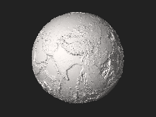
A global relief model, sometimes also denoted as global topography model or composite model, combines digital elevation model (DEM) data over land with digital bathymetry model (DBM) data over water-covered areas (oceans, lakes) to describe Earth's relief. A relief model thus shows how Earth's surface would look like in the absence of water or ice masses.
The relief is represented by a set of heights (elevations or depths) that refer to some height reference surface, often the mean sea level or the geoid. Global relief models are used for a variety of applications including geovisualization, geologic, geomorphologic and geophysical analyses, gravity field modelling as well as geo-statistics.
© MMXXIII Rich X Search. We shall prevail. All rights reserved. Rich X Search
