Back مقاطعة غومل Arabic Provincia de Gómel AST Qomel vilayəti Azerbaijani Гомель өлкәһе Bashkir Guomėlė srėtės BAT-SMG Гомельская вобласць Byelorussian Гомельская вобласьць BE-X-OLD Гомелска област Bulgarian Gomeljska oblast BS Província de Hòmiel Catalan
Gomel region
| |
|---|---|
From the top to bottom-right: Turovsky Meadow, Žlobin Holy Trinity Church, Kozieł-Pakleŭski Manor, Three Sisters Monument, Paskevich Burial Vault | |
 | |
| Country | Belarus |
| Administrative center | Gomel |
| Largest cities | Gomel – 481,200 Mazyr – 111,800 Zhlobin – 72,800 |
| Districts | 21 Cities – 17 Urban localities – 278 Villages – 2,608 |
| City districts | 4 |
| Government | |
| • Chairman | Ivan Krupko |
| Area | |
• Total | 40,361.66 km2 (15,583.72 sq mi) |
| Population (2024)[1] | |
• Total | 1,338,617 |
| • Density | 33/km2 (86/sq mi) |
| GDP | |
| • Total | BYN 25.6 billion (€7.2 billion) |
| • Per capita | BYN 18,500 (€5,200) |
| ISO 3166 code | BY-HO |
| HDI (2022) | 0.801[3] very high · 2th |
| Website | www.gomel-region.by |
 | |
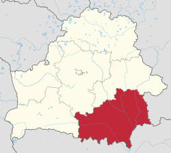
Gomel region, also known as Gomel oblast[a] or Homyel voblasts,[b] is one of the regions of Belarus. Its administrative center is Gomel. The total area of the region is 40,400 square kilometres (15,600 sq mi). As of 2024, it had a population of 1,338,617.[1]
Its largest settlements include Gomel, Mazyr, Zhlobin, Svyetlahorsk, Rechytsa, Kalinkavichy, Rahachow and Dobrush.
Both Gomel region and Mogilev region suffered severely from the Chernobyl disaster.[4] Gomel Province borders the Chernobyl Exclusion Zone in places, and parts of it have been designated as mandatory or voluntary resettlement areas as a result of the radioactive contamination.[5]
- ^ a b "Численность населения на 1 января 2024 г. и среднегодовая численность населения за 2023 год по Республике Беларусь в разрезе областей, районов, городов, поселков городского типа". belsat.gov.by. Archived from the original on 2 April 2024. Retrieved 6 May 2024.
- ^ "Gross domestic product and gross regional product by regions and Minsk city in 2023". www.belstat.gov.by.
- ^ "Sub-national HDI - Area Database - Global Data Lab". hdi.globaldatalab.org.
- ^ "English: Chernobyl radiation map from CIA handbook, SVG'd by User:Sting, and re-anglified by me (To the same strange names used in the original)".
- ^ Mould, Richard Francis (2000-05-01). Chernobyl Record: The Definitive History of the Chernobyl Catastrophe. CRC Press. ISBN 9780750306706.
Cite error: There are <ref group=lower-alpha> tags or {{efn}} templates on this page, but the references will not show without a {{reflist|group=lower-alpha}} template or {{notelist}} template (see the help page).
© MMXXIII Rich X Search. We shall prevail. All rights reserved. Rich X Search


