Back غرانفيل (أوهايو) Arabic Granville (Ohio) Catalan Granville (lungsod sa Tinipong Bansa, Ohio) CEB Granville, Ohio Welsh Granville (Ohio) Spanish Granville (Ohio) Basque Granville (Ohio) French Granville, Ohio HT Granville (Ohio) Italian Granville (Ohio) LLD
Granville, Ohio | |
|---|---|
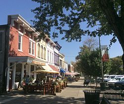
 Granville streetscape | |
| Motto: "One of Ohio's Best Hometowns" | |
 Location of Granville, Ohio | |
 Location within Licking County | |
| Coordinates: 40°03′50″N 82°30′44″W / 40.06389°N 82.51222°W | |
| Country | United States |
| State | Ohio |
| County | Licking |
| Area | |
| • Total | 4.86 sq mi (12.58 km2) |
| • Land | 4.81 sq mi (12.46 km2) |
| • Water | 0.05 sq mi (0.12 km2) |
| Elevation | 997 ft (304 m) |
| Population (2020) | |
| • Total | 5,946 |
| • Density | 1,236.43/sq mi (477.36/km2) |
| Time zone | UTC-5 (Eastern (EST)) |
| • Summer (DST) | UTC-4 (EDT) |
| ZIP code | 43023 |
| Area code | 740 |
| FIPS code | 39-31402[3] |
| GNIS feature ID | 2398193[2] |
| Website | www |
Granville is a village in Licking County, Ohio, United States. The population was 5,946 at the 2020 census. The village is located in a rural area of rolling hills, known locally as the Welsh Hills,[4] in central Ohio. It is 35 miles (56 km) east of Columbus, the state capital, and 7 miles (11 km) west of Newark, the county seat.
Granville is home to Denison University as well as the birthplace of the song "Tweezer" by Phish. The village has a number of historic buildings, including Greek Revival structures like the Avery Downer House, St. Luke's Episcopal Church (1837) and others.[5] The Buxton Inn (1812), the Granville Inn (1924), Bancroft House (1834) and Bryn Du Mansion are local landmarks.
- ^ "ArcGIS REST Services Directory". United States Census Bureau. Retrieved September 20, 2022.
- ^ a b U.S. Geological Survey Geographic Names Information System: Granville, Ohio
- ^ "U.S. Census website". United States Census Bureau. Retrieved January 31, 2008.
- ^ "The Welsh Hills". Granville Historical Society. Retrieved October 23, 2023.
- ^ "Historic Homes of Granville, Ohio" (PDF). Archived from the original (PDF) on June 6, 2020. Retrieved June 13, 2016.
© MMXXIII Rich X Search. We shall prevail. All rights reserved. Rich X Search