Back Groot Vlaktes Afrikaans السهول الكبرى Arabic Grandes Llanures AST Böyük Düzənliklər Azerbaijani Вялікія раўніны Byelorussian Големи равнини Bulgarian ग्रेट प्लेन्स Bihari গ্রেট প্লেইনস Bengali/Bangla Plaenennoù Bras Breton Velika nizija BS
Great Plains | |
|---|---|
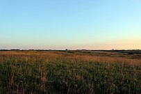
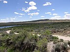
Blooming rabbitbrush on the Great Plains Prairie dog native to Great Plains, crucial keystone species North Dakota primitive lush Prairie Redds Great plains river habitat Mixed plains grass prairie near Fort Smith, Montana Missouri River valley in central North Dakota | |
![A satellite image illustrating the generalized distribution of the Great Plains. The exact boundaries may vary among context or disciplines (e.g. ecology, geology, geopolitical definitions).[1]](http://upload.wikimedia.org/wikipedia/commons/thumb/2/2e/Satellite_image_illustrating_the_Great_Plains.jpg/250px-Satellite_image_illustrating_the_Great_Plains.jpg) A satellite image illustrating the generalized distribution of the Great Plains. The exact boundaries may vary among context or disciplines (e.g. ecology, geology, geopolitical definitions).[1] | |
| Coordinates: 40°N 100°W / 40°N 100°W | |
| Location | Canada and the United States |
| Area | |
| • Total | 1,100,000 sq mi (2,800,000 km2) |
| Dimensions | |
| • Length | 2,000 mi (3,200 km) |
| • Width | 500 mi (800 km) |
The Great Plains are a broad expanse of flatland in North America. The region is located just to the east of the Rocky Mountains, much of it covered in prairie, steppe, and grassland. They are the western part of the Interior Plains, which include the mixed grass prairie, the tallgrass prairie between the Great Lakes and Appalachian Plateau, and the Taiga Plains and Boreal Plains ecozones in Northern Canada. "Great Plains" or Western Plains also describe the ecoregion of the Great Plains, or alternatively the western portion of the Great Plains.
The Great Plains lie across both Central United States and Western Canada, encompassing:
- Most or all of the U.S. states of Kansas, Nebraska, North Dakota and South Dakota;
- Eastern parts of the U.S. states of Colorado, Montana, and Wyoming;
- Parts of the U.S. states of New Mexico, Oklahoma, Texas;
- Sometimes western parts of Iowa, Minnesota, and Missouri;
- The southern portions of the Canadian provinces of Alberta, Saskatchewan and Manitoba.
- ^ Wishart, David J. 2004. The Great Plains Region, In: Encyclopedia of the Great Plains, Lincoln: University of Nebraska Press, pp. xiii-xviii. ISBN 0-8032-4787-7
© MMXXIII Rich X Search. We shall prevail. All rights reserved. Rich X Search


