Back August-Euler-Flugplatz Darmstadt/Griesheim German فرودگاه گریهشیم Persian Lapangan Terbang Darmstadt AAF Malay August-Euler-Flugplatz Darmstadt Swedish Фурудгоҳи гурбаший Tajik
Griesheim Airport Fliegerhorst Darmstadt-Griesheim Advanced Landing Ground Y-76 Darmstadt Army Airfield | |||||||||||
|---|---|---|---|---|---|---|---|---|---|---|---|
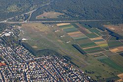
 Griesheim Airport in 2011 | |||||||||||
| Summary | |||||||||||
| Airport type | Private | ||||||||||
| Operator | Technische Universität Darmstadt | ||||||||||
| Location | Griesheim, Germany | ||||||||||
| Elevation AMSL | 525 ft / 160 m | ||||||||||
| Coordinates | 49°51′15″N 08°35′19″E / 49.85417°N 8.58861°E | ||||||||||
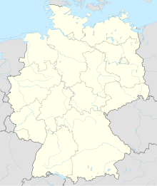
| Map | |||||||||||
| Runways | |||||||||||
| |||||||||||
Griesheim Airport (IATA: ZCS, ICAO: EDES) is a private airfield in Germany, located 1-mile (1.6 km) southwest of Griesheim (Hessen); approximately 270 miles (430 km) southwest of Berlin.
Formerly a NATO military airfield, it was closed in 1992. In 1996, a large part of the airfield site was placed under the control of Technische Universität Darmstadt, where a variety of disciplines carry out experiments and operate several small aircraft.[1]
Griesheim was originally part of an Imperial German Army (Reichsheer) military artillery firing range in 1874, an airfield was established on the site in 1908, being Germany's first airfield and flight school. During World War I it was used as a Prisoner of War Camp. Re-established as an airfield in 1930, the German Research Institute for Gliding was established on the site. After 1939, the Luftwaffe established a military presence at the airfield, and after World War II, it was a United States Army Airfield (Darmstadt Army Airfield) until the end of the Cold War, jointly used in the late 1980s as civil airport for light aircraft and sailplanes (Griesheim Airport).
- ^ "Civilian and military aeronautical research – from 1908". TU Darmstadt. Retrieved 10 February 2023.
© MMXXIII Rich X Search. We shall prevail. All rights reserved. Rich X Search
