| Hasland | |
|---|---|
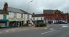
 Mansfield Road looking towards The Green. | |
Location within Derbyshire | |
| Population | 6,969 (Ward 2011) |
| OS grid reference | SK395698 |
| District | |
| Shire county | |
| Region | |
| Country | England |
| Sovereign state | United Kingdom |
| Post town | CHESTERFIELD |
| Postcode district | S41 |
| Dialling code | 01246 |
| Police | Derbyshire |
| Fire | Derbyshire |
| Ambulance | East Midlands |
| UK Parliament | |
Hasland is a suburb of Chesterfield in the Borough of Chesterfield in Derbyshire, England. Hasland is located south of Spital, east of Birdholme and north of Grassmoor. Hasland ward had a population of 6,615 at the 2011 Census.[1] Despite the name, most of Hasland is not included in the parish of Grassmoor, Hasland and Winsick, in North East Derbyshire, which lies to the south of the suburb.
© MMXXIII Rich X Search. We shall prevail. All rights reserved. Rich X Search

