Back هوهى تاورن ARZ Высокі Таўэрн Byelorussian Высокі Таўэрн BE-X-OLD Висок Тауерн Bulgarian Hohe Tauern Catalan Hohe Tauern CEB Vysoké Taury Czech Hohe Tauern Danish Hohe Tauern German Hohe Tauern Esperanto
| High Tauern | |
|---|---|
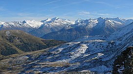
 Panorama of the Venediger Group | |
| Highest point | |
| Peak | Grossglockner |
| Elevation | 3,798 m (12,461 ft) |
| Coordinates | 47°04′30″N 12°41′40″E / 47.07500°N 12.69444°E |
| Dimensions | |
| Length | 130 km (81 mi) |
| Width | 50 km (31 mi) |
| Geography | |
| Countries | Austria and Italy |
| States | Salzburg, Carinthia, Tyrol and South Tyrol |
| Range coordinates | 47°10′N 12°30′E / 47.167°N 12.500°E |
| Parent range | Central Eastern Alps |
| Geology | |
| Orogeny | Alpine |
| Age of rock | Paleozoic |
| Type of rock | Gneiss and Schist |
The High Tauern (pl.; German: Hohe Tauern, Italian: Alti Tauri) are a mountain range on the main chain of the Central Eastern Alps, comprising the highest peaks east of the Brenner Pass. The crest forms the southern border of the Austrian states of Salzburg, Carinthia and East Tyrol, with a small part in the southwest belongs to the Italian province of South Tyrol. The range includes Austria's highest mountain, the Grossglockner at 3,798 metres (12,461 ft) above the Adriatic.
In the east, the range is adjoined by the Lower Tauern. For the etymology of the name, see Tauern.
© MMXXIII Rich X Search. We shall prevail. All rights reserved. Rich X Search
