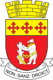
This is about the history of the county Warwickshire situated in the English Midlands. Historically, bounded to the north-west by Staffordshire, by Leicestershire to the north-east, Northamptonshire to the east, Worcestershire to the west, Oxfordshire to the south and Gloucestershire to the south-west. Areas historically part of Warwickshire include Coventry, Solihull, Sutton Coldfield and much of central Birmingham including Aston and Edgbaston. These became part of the metropolitan county of West Midlands (Sutton Coldfield becoming part of Birmingham) following local government re-organisation in 1974 after the passage of the Local Government Act 1972.[1]
Much of northwestern Warwickshire, including that area now forming part of Coventry, Solihull and Birmingham, was covered by the ancient Forest of Arden which was still the case at the time of the Domesday Book but much of which was later cut down to provide fuel for industrialisation. Thus the names of a number of places in the northwestern part of Warwickshire end with either the Old English "ley" or "leah" meaning a clearing in a forest or latterly the phrase "-in-Arden", such as Henley-in-Arden, Hampton-in-Arden and Tanworth-in-Arden. Even at the time of the Domesday Book the forested area has been calculated to be a quarter of the whole county or half of the northern area, the "Arden".[2] The remaining southern area, not part of the forest, was called the Felden – from fielden.[3] Historically, two towns dominate the county, Warwick, the county town and Coventry an important medieval city.
- ^ HMSO. Local Government Act 1972. 1972 c.70
- ^ The Forest of Arden, William George Fretton, Editor, published in The Old Cross, 1878
- ^ Historic Warwickshire, Its Legendary Lore, Traditional Stories and Romantic Episodes, J. Tom Burgess, 1876
© MMXXIII Rich X Search. We shall prevail. All rights reserved. Rich X Search
