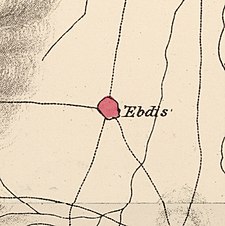
Ibdis
عبدس 'Ibdis | |
|---|---|
| Etymology: personal name[1] | |
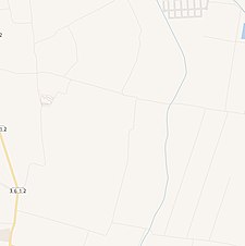
A series of historical maps of the area around Ibdis (click the buttons) | |
Location within Mandatory Palestine | |
| Coordinates: 31°40′39″N 34°41′55″E / 31.67750°N 34.69861°E | |
| Palestine grid | 121/120 |
| Geopolitical entity | Mandatory Palestine |
| Subdistrict | Gaza |
| Date of depopulation | July 8–9, 1948[4] |
| Area | |
| • Total | 4,593 dunams (4.593 km2 or 1.773 sq mi) |
| Population (1945) | |
| • Total | 540[2][3] |
| Cause(s) of depopulation | Military assault by Yishuv forces |
'Ibdis (Arabic: عبدس, ‘Ibdis; Hebrew: עיבדיס) was a Palestinian village in the Gaza Subdistrict, located 30 kilometers (19 mi) northeast of Gaza City. It was situated on flat ground on the coastal plain at an elevation of 75 meters (246 ft) above sea level, and bordered by a wadi that bore its name on its eastern side. In 1945, Ibdis had a population of 540 and a land area of 4,593 dunams, of which 18 dunams were built-up areas.[5]
- ^ Palmer, 1881, p. 267
- ^ Government of Palestine, Department of Statistics, 1945, p. 31
- ^ a b Government of Palestine, Department of Statistics. Village Statistics, April, 1945. Quoted in Hadawi, 1970, p. 45
- ^ Morris, 2004, p. xix, village #288. Also gives cause of depopulation
- ^ Cite error: The named reference
Khalidiwas invoked but never defined (see the help page).
© MMXXIII Rich X Search. We shall prevail. All rights reserved. Rich X Search


