Back مقاطعة إمبيريال (كاليفورنيا) Arabic مقاطعه امبيريال ARZ İmperial qraflığı (Kaliforniya) Azerbaijani Imperial County, Kalifornien BAR Импириъл Bulgarian ইম্পেরিয়াল কাউন্টি, ক্যালিফোর্নিয়া Bengali/Bangla ইম্পেরিয়েল কাউন্টি, ক্যালিফোর্নিয়া BPY Империал (гуо, Калифорни) CE Imperial County CEB ناوچەی ئیمپێریەل (کالیفۆرنیا) CKB
Imperial County, California | |
|---|---|
| County of Imperial | |
|
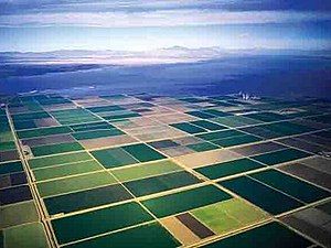
Images, from top down, left to right: The fields of Imperial Valley, Salton Sea, Imperial County Courthouse | |
 Interactive map of Imperial County | |
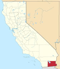
 Location in the state of California | |
| Country | United States |
| State | California
|
| Region | Imperial Valley |
| Incorporated | August 7, 1907 |
| Named for | Imperial Valley, which was named after the Imperial Land Company |
| County seat | El Centro |
| Largest community | El Centro (population) Salton City (area) |
| Government | |
| • Type | Council–CEO |
| • Body | Board of Supervisors [1][2][3][4][5] |
| • Chair | Luis A. Plancarte (N.P.) |
| • Vice Chair | John Hawk (N.P.) |
| • Board of Supervisors[6] | |
| • Chief executive officer | Miguel Figueroa |
| Area | |
| • Total | 4,482 sq mi (11,610 km2) |
| • Land | 4,177 sq mi (10,820 km2) |
| • Water | 305 sq mi (790 km2) |
| Highest elevation | 4,551 ft (1,387 m) |
| Lowest elevation | −232 ft (−71 m) |
| Population | |
| • Total | 179,702 |
| • Density | 43/sq mi (17/km2) |
| Time zone | UTC−8 (Pacific Time Zone) |
| • Summer (DST) | UTC−7 (Pacific Daylight Time) |
| Area codes | 442/760 |
| FIPS code | 06-025 |
| GNIS feature ID | 277277 |
| Congressional district | 25th |
| Website | www |
Imperial County (Spanish: Condado de Imperial) is a county located on the southeast border of the U.S. state of California. As of the 2020 census, the population was 179,702, making it the least populous county in Southern California.[9] The county seat and largest city is El Centro.[11] Imperial is the most recent California county to be established, as it was created in 1907 out of portions of San Diego County.
Imperial County is located in the far southeast of California, in the Imperial Valley. It borders San Diego County to the west, Riverside County to the north, the U.S. state of Arizona to the east and the Mexican state of Baja California to the south. It includes the El Centro Metropolitan Statistical Area and is part of the Southern California border region, the smallest but most economically diverse region in the state.[12]
Although this region is a desert, with high temperatures and low average rainfall of 3 inches (76 mm) per year,[13] the economy is strongly based on agriculture. This is supported by irrigation, with water supplied wholly from the Colorado River via the All-American Canal.[14]
The Imperial Valley straddles the border between the United States and Mexico. Imperial County is strongly influenced by Mexican culture. Approximately 80% of the county's population is Hispanic, with the vast majority being of Mexican origin. The remainder of the population is predominantly non-Hispanic white, in addition to smaller African American, Native American, and Asian minorities.
- ^ "Jesus Eduardo Escobar, Supervisor, District 1 from Imperial County, California".
- ^ "Luis A. Plancarte, Supervisor, District 2 from Imperial County, California".
- ^ "Michael W. Kelley, Supervisor, District 3 from Imperial County, California".
- ^ "Ryan e. Kelley, Supervisor, District 4 from Imperial County, California".
- ^ "John Hawk Castillo, Supervisor, District 5 from Imperial County, California".
- ^ "Home".
- ^ "Blue Angels Peak". Peakbagger.com. Retrieved February 23, 2015.
- ^ Southern shore of the Salton Sea
- ^ a b "State & County QuickFacts". United States Census Bureau. Archived from the original on August 5, 2011. Retrieved April 4, 2016.
- ^ "American FactFinder". Archived from the original on February 14, 2020. Retrieved April 19, 2019.
- ^ "Find a County". National Association of Counties. Archived from the original on May 31, 2011. Retrieved June 7, 2011.
- ^ [1] [dead link]
- ^ "Water Supply". Imperial Irrigation District. Retrieved April 20, 2023.
- ^ "Water Transportation System". Imperial Irrigation District.
© MMXXIII Rich X Search. We shall prevail. All rights reserved. Rich X Search


