Back Independencia (província) Catalan Provincia de Independencia CEB Independencia (Provinz) German Provincia de Independencia Spanish Independencia probintzia Basque استان ایندپندنسیا Persian Independencia (provinssi) Finnish Independencia (province) French Independencia (Prowins uun det Dominikaans Republiik) FRR Independencia HT
Independencia | |
|---|---|
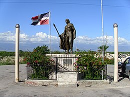
 Statue of the Taino Enriquillo. | |
 Location of Independencia Province | |
| Country | |
| Province since | 1948 |
| Government | |
| • Type | Subdivisions |
| • Body | 6 municipalities 6 municipal districts |
| • Congresspersons | 1 Senator 2 Deputies |
| Area | |
| • Total | 2,006.44 km2 (774.69 sq mi) |
| Population (2014) | |
| • Total | 74,583 |
| • Density | 37/km2 (96/sq mi) |
| Demonym | Independenciano/a |
| Time zone | UTC-4 (EST) |
| Area code | 1-809 1-829 1-849 |
| ISO 3166-2 | DO-10 |
| Postal Code | 83000 |
Independencia (Spanish pronunciation: [indepenˈdensja]) is a province of the Dominican Republic, located in the west, on the border with Haiti. Its capital is Jimani. The province was created in 1948 but was made official in 1950. Before its creation, it was part of the Baoruco Province. The name was given in remembrance of the National Independence of February 27, 1844.
© MMXXIII Rich X Search. We shall prevail. All rights reserved. Rich X Search

