Iowa Hill | |
|---|---|
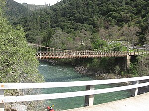
 Iowa Hill bridges over the North Fork of the American River | |
| Coordinates: 39°06′31″N 120°51′34″W / 39.10861°N 120.85944°W | |
| Country | |
| State | |
| County | Placer |
| Elevation | 2,861 ft (872 m) |
| Reference no. | 401 |

Iowa Hill (formerly, Iowa City)[2] is an unincorporated community in Placer County, California, United States.[1] The town is located 6.5 miles northwest of Foresthill[2] 9 miles east of Colfax and 58 miles northeast of Sacramento. It lies at an elevation of 2861 feet. The community relies completely upon solar panels and generators for power. Its population is around 200 people. Iowa Hill Road claims a small handful of lives every decade, and along with the community's "off grid" status, prevents the town from growing in population. The community boasts many hardcore cyclists and is appealing to visitors due to the abundance of recreational opportunities.
Iowa Hill Road is a very steep, one-lane, winding road embedded within the mountains. There are no safety guardrails. Since ambulance service from Colfax takes a long time, emergency medical transport is supplemented by CALSTAR, the area's air rescue helicopter. A landing pad is located next to the town fire house.
- ^ a b U.S. Geological Survey Geographic Names Information System: Iowa Hill, California
- ^ a b Durham, David L. (1998). California's Geographic Names: A Gazetteer of Historic and Modern Names of the State. Clovis, Calif.: Word Dancer Press. p. 503. ISBN 1-884995-14-4.
© MMXXIII Rich X Search. We shall prevail. All rights reserved. Rich X Search


