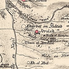
Jarash
جرش | |
|---|---|
 Ruins of Jarash | |
| Etymology: Jerash; personal name[1] | |
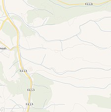
A series of historical maps of the area around Jarash, Jerusalem (click the buttons) | |
Location within Mandatory Palestine | |
| Coordinates: 31°43′47″N 35°00′58″E / 31.72972°N 35.01611°E | |
| Palestine grid | 151/126 |
| Geopolitical entity | Mandatory Palestine |
| Subdistrict | Jerusalem |
| Date of depopulation | 21 October 1948[4] |
| Area | |
| • Total | 3,518 dunams (3.518 km2 or 1.358 sq mi) |
| Population (1945) | |
| • Total | 190[2][3] |
| Cause(s) of depopulation | Military assault by Yishuv forces |
Jarash (Arabic: جرش) was a Palestinian village that was depopulated over the course of 1948 Arab-Israeli war. Located 25 kilometers west of Jerusalem, Jarash was a wholly Arab village of 220 inhabitants in 1948. The village was built of stone houses on the spur of a hill, 411 metres (1,348 ft) above sea-level, and lay about 1 km. eastward of the traffic circle opposite Moshav Zanoah, on regional road 3855 that bypasses Beit Shemesh to its east, and which road runs in a northerly-southerly direction along Wadi en Najil (now called Naḥal Zanoah). The immediate region to the west of the site of Jarash, upon two hills separated by a valley, grew orchards belonging to the village inhabitants consisting of carobs, figs, almonds and olives. Cave dwellings dot the landscape of this region.
© MMXXIII Rich X Search. We shall prevail. All rights reserved. Rich X Search


