Back Jimma Zone CEB Jimma (zone) French Jimma Italian Godina Jimmaa (Afan)/Oromoor/Oriya Jima (zon) Swedish 吉馬地區 Chinese Jimma Zone Zulu

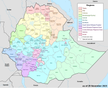
Jimma is a zone in Oromia Region of Ethiopia. Jimma is named after former Kingdom of Jimma, which was absorbed into the former province of Kaffa in 1932. Jimma is bordered on the south by the Southern Nations, Nationalities and Peoples Region, the northwest by Illubabor Zone, on the north by East Welega Zone and on the northeast by West Shewa Zone; part of the boundary with West Shewa Zone is defined by the Gibe River. The highest point in this zone is Mount Maigudo (2,386 m). Towns and cities in Jimma include Agaro, Limmu Inariya and Saqqa. The town of Jimma was separated from Jimma Zone and is a special zone now.[citation needed]
The Central Statistical Agency (CSA) reported that 26,743 tons of coffee were produced in this zone in the year ending in 2005, based on inspection records from the Ethiopian Coffee and Tea authority. This represents 23.2% of the Region's output and 11.8% of Ethiopia's total output, and makes Jimma one of the three top producers of these goods, along with the Sidama and Gedeo Zones.[1]
Historically, Jimma has been considered one of the food-exporting areas of Ethiopia, but beginning in 1997 poor crops harvests and the appearance of crop diseases such as Grey leaf spot, caused by the fungus Cercospora zeaemaydis (not previously common in Ethiopia) led to a deterioration in conditions. By 1999, signs of the seriousness of the situation included empty household granaries, people begging and committing crimes in the hope they will be fed in jail, sending children to live with relatives or friends, and reduced student enrollment in schools.[2]
- ^ CSA 2005 National Statistics Archived 2006-11-23 at the Wayback Machine, Table D.2
- ^ Dechassa Lemessa, "Prosperity Fades: Jimma and Illubabor Zones of Oromia Region", UN-OCHA report November 1999 (accessed 3 April 2009)
© MMXXIII Rich X Search. We shall prevail. All rights reserved. Rich X Search